Ecosyste.ms: Awesome
An open API service indexing awesome lists of open source software.
https://github.com/banesullivan/localtileserver
🌐 dynamic tile server for visualizing rasters in Jupyter with ipyleaflet or folium
https://github.com/banesullivan/localtileserver
cesiumjs dynamic-tiling flask flask-application flask-blueprint folium geospatial gis ipyleaflet ipywidgets jupyter large-image localtileserver map-tiles python raster satellite-imagery visualization
Last synced: about 2 months ago
JSON representation
🌐 dynamic tile server for visualizing rasters in Jupyter with ipyleaflet or folium
- Host: GitHub
- URL: https://github.com/banesullivan/localtileserver
- Owner: banesullivan
- License: mit
- Created: 2021-11-18T04:47:16.000Z (over 2 years ago)
- Default Branch: main
- Last Pushed: 2024-05-01T21:54:45.000Z (2 months ago)
- Last Synced: 2024-05-02T15:14:00.358Z (about 2 months ago)
- Topics: cesiumjs, dynamic-tiling, flask, flask-application, flask-blueprint, folium, geospatial, gis, ipyleaflet, ipywidgets, jupyter, large-image, localtileserver, map-tiles, python, raster, satellite-imagery, visualization
- Language: Python
- Homepage: https://localtileserver.banesullivan.com
- Size: 111 MB
- Stars: 279
- Watchers: 12
- Forks: 27
- Open Issues: 11
-
Metadata Files:
- Readme: README.md
- License: LICENSE
Lists
- awesome-open-geoscience - localtileserver
- Awesome-Geospatial - localtileserver - A Python package for serving tiles from large raster files in the Slippy Maps standard (i.e., `/zoom/x/y.png`) for visualization in Jupyter with `ipyleaflet` or `folium`. (Python)
- awesome-open-geoscience - localtileserver
- awesome-gis - localtileserver - Easily visualize large geospatial images with ipyleaflet or folium in Jupyter or in a web browser with CesiumJS. (Geospatial Library / Python)
- awesome-stars - banesullivan/localtileserver - 🌐 dynamic tile server for visualizing rasters in Jupyter with ipyleaflet or folium (Python)
README
# 🌐 Local Tile Server for Geospatial Rasters
[](https://codecov.io/gh/banesullivan/localtileserver)
[](https://pypi.org/project/localtileserver/)
[](https://anaconda.org/conda-forge/localtileserver)
*Need to visualize a rather large (gigabytes+) raster?* **This is for you.**
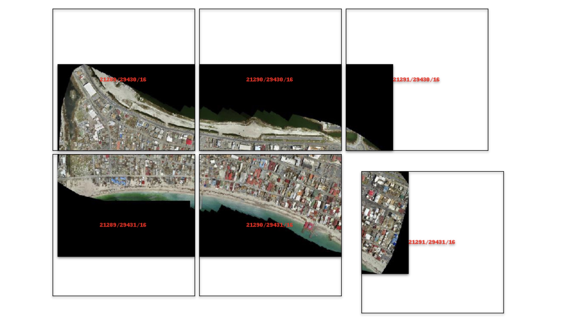
A Python package for serving tiles from large raster files in
the [Slippy Maps standard](https://wiki.openstreetmap.org/wiki/Slippy_map_tilenames)
(i.e., `/zoom/x/y.png`) for visualization in Jupyter with `ipyleaflet` or `folium`.
Launch a [demo](https://github.com/banesullivan/localtileserver-demo) on MyBinder [](https://mybinder.org/v2/gh/banesullivan/localtileserver-demo/HEAD)
Documentation: https://localtileserver.banesullivan.com/
Under the hood, this is also a Flask blueprint/application for use as a
standalone web app or in your own web deployments needing dynamic tile serving.
## 🌟 Highlights
- Launch a tile server for large geospatial images
- View local or remote* raster files with `ipyleaflet` or `folium` in Jupyter
- View rasters with CesiumJS with the built-in Flask web application
- Extract regions of interest (ROIs) interactively
- Use the example datasets to generate Digital Elevation Models
**remote raster files should be pre-tiled Cloud Optimized GeoTiffs*
## 🚀 Usage
Usage details and examples can be found in the documentation: https://localtileserver.banesullivan.com/
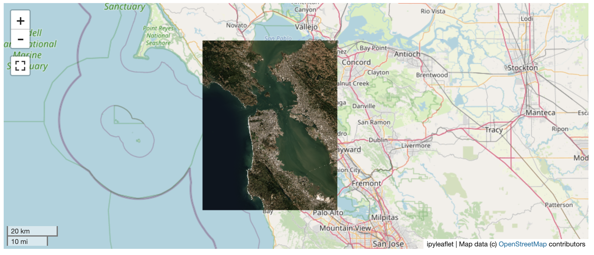
The following is a minimal example to visualize a local raster file with
`ipyleaflet`:
```py
from localtileserver import get_leaflet_tile_layer, TileClient
from ipyleaflet import Map
# First, create a tile server from local raster file
client = TileClient('path/to/geo.tif')
# Create ipyleaflet tile layer from that server
t = get_leaflet_tile_layer(client)
m = Map(center=client.center(), zoom=client.default_zoom)
m.add_layer(t)
m
```
## ℹ️ Overview
The `TileClient` class can be used to to launch a tile server in a background
thread which will serve raster imagery to a viewer (usually `ipyleaflet` or
`folium` in Jupyter notebooks).
This tile server can efficiently deliver varying resolutions of your
raster imagery to your viewer; it helps to have pre-tiled,
[Cloud Optimized GeoTIFFs (COGs)](https://www.cogeo.org/), but no wories if
not as the backing library, [`large_image`](https://github.com/girder/large_image),
will tile and cache for you when opening the raster.
There is an included, standalone web viewer leveraging
[CesiumJS](https://cesium.com/platform/cesiumjs/) and [GeoJS](https://opengeoscience.github.io/geojs/).
You can use the web viewer to select and extract regions of interest from rasters.
## ⬇️ Installation
Get started with `localtileserver` to view rasters in Jupyter or deploy as your
own Flask application.
### 🐍 Installing with `conda`
Conda makes managing `localtileserver`'s dependencies across platforms quite
easy and this is the recommended method to install:
```bash
conda install -c conda-forge localtileserver
```
### 🎡 Installing with `pip`
If you prefer pip, then you can install from PyPI: https://pypi.org/project/localtileserver/
```
pip install localtileserver
```
## 💭 Feedback
Please share your thoughts and questions on the [Discussions](https://github.com/banesullivan/localtileserver/discussions) board.
If you would like to report any bugs or make feature requests, please open an issue.
If filing a bug report, please share a scooby `Report`:
```py
import localtileserver
print(localtileserver.Report())
```