https://github.com/CarlosBergillos/xplane_apt_convert
Convert X-Plane airport data to GIS-friendly formats like GeoJSON or ESRI Shapefile.
https://github.com/CarlosBergillos/xplane_apt_convert
airport airports fiona flatgeobuf geobuf geojson geopackage gis gpkg ogr shapefile xplane
Last synced: 18 days ago
JSON representation
Convert X-Plane airport data to GIS-friendly formats like GeoJSON or ESRI Shapefile.
- Host: GitHub
- URL: https://github.com/CarlosBergillos/xplane_apt_convert
- Owner: CarlosBergillos
- License: mit
- Created: 2022-07-17T22:25:02.000Z (almost 4 years ago)
- Default Branch: main
- Last Pushed: 2026-05-17T16:16:18.000Z (2 months ago)
- Last Synced: 2026-06-25T04:05:12.346Z (22 days ago)
- Topics: airport, airports, fiona, flatgeobuf, geobuf, geojson, geopackage, gis, gpkg, ogr, shapefile, xplane
- Language: Python
- Homepage:
- Size: 1.66 MB
- Stars: 24
- Watchers: 2
- Forks: 4
- Open Issues: 0
-
Metadata Files:
- Readme: README.md
- License: LICENSE
Awesome Lists containing this project
- awesome-osxp - X-Plane APT file Converter
README
# X-Plane apt.dat convert




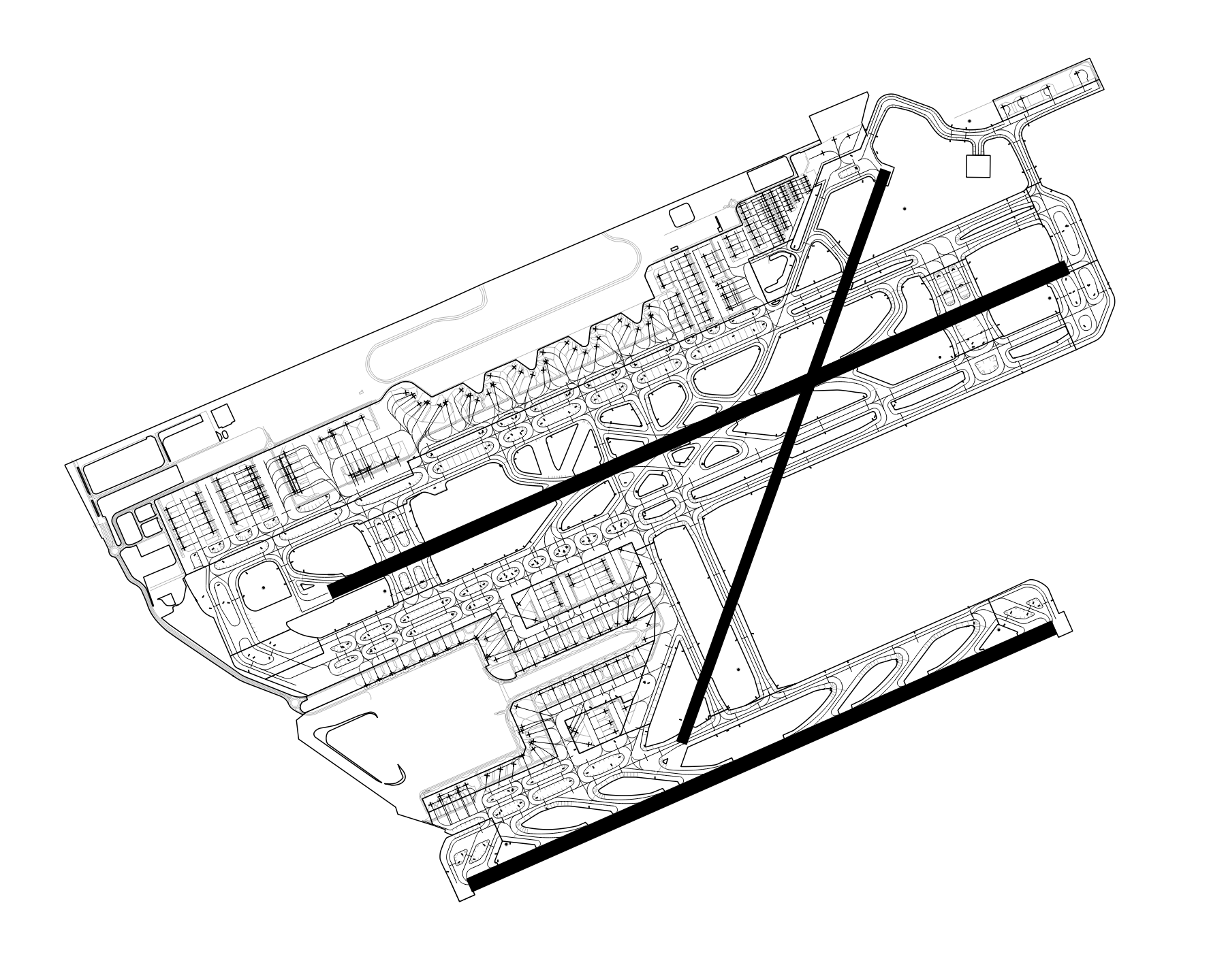
`xplane_apt_convert` is a Python package and CLI application allowing to convert X-Plane airport data to GIS-friendly formats like GeoJSON or ESRI Shapefile.
[](https://raw.githubusercontent.com/CarlosBergillos/xplane_apt_convert/main/images/example_LEBL.png)
## Input
X-Plane `apt.dat` files are used as input.
Two input modes exist:
- Load a local `apt.dat` file.
- Automatically download airport-specific files from the [X-Plane Scenery Gateway](https://gateway.x-plane.com/).
**Note:** Only tested with `apt.dat` files version 1100.
## Output
The following output formats are supported:
| Format | Extension |
| :------------------------- | :---------- |
| ESRI Shapefile | `.shp` |
| FlatGeobuf | `.fgb` |
| GeoJSON | `.geojson` |
| GeoJSON lines (GeoJSONSeq) | `.geojsonl` |
| GeoPackage (GPKG) | `.gpkg` |
| GML | `.gml` |
| OGR_GMT | `.gmt` |
| SQLite | `.sqlite` |
## Supported Features
The following airport features are supported:
- **Windsocks** (row code `19`)
- **Ground signs** (row code `20`)
- **Runways** (row code `100`)
- **Pavement areas (taxiway and aprons)** (header row code `110`)
- **Ground markings (linear features)** (header row code `120`)
- **Airport boundary** (header row code `130`)
- **Aircraft startup locations (parking and gates)** (row code `1300`)
- **Airport metadata** (row code `1302`)
## Installation
The `xplane_apt_convert` Python package can be installed using pip:
```console
pip install xplane_apt_convert
```
**Python 3.10 and above**
When using Python 3.10 and above, you might encounter the following error during the installation of the `bezier` dependency:
`The BEZIER_INSTALL_PREFIX environment variable must be set.`
To solve it, you can install the pure Python version of the `bezier` package by running:
```console
BEZIER_NO_EXTENSION=true pip install bezier --no-binary=bezier
```
And then try installing `xplane_apt_convert` again.
See [dhermes/bezier/issues/283](https://github.com/dhermes/bezier/issues/283) for more details about this issue.
## CLI Basic Usage
Convert an airport in a local `apt.dat` file to GeoJSON:
```console
python -m xplane_apt_convert -a LEBL -i ./apt.dat -o ./out/ -d GeoJSON
```
Convert multiple airports:
```console
python -m xplane_apt_convert -a LEBL,LEGE,LERS,LELL -i ./apt.dat -o ./out/ -d GeoJSON
```
Download the recommended airport data files from the X-Plane Scenery Gateway and convert them:
```console
python -m xplane_apt_convert -a LEBL,LEGE,LERS,LELL -g -o ./out/ -d GeoJSON
```
Other output file formats are available using the `-d` option, for example `GeoJSON`, `ESRI Shapefile`, or `GPKG`.
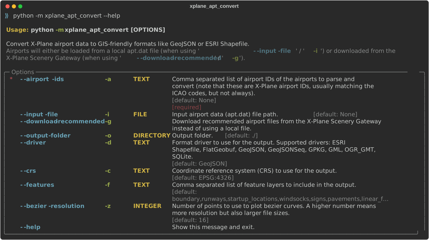
For information about all available options run the command using `--help`.
[](https://raw.githubusercontent.com/CarlosBergillos/xplane_apt_convert/main/images/cli_help.svg)
## Python Basic Usage
Convert an airport in a local `apt.dat` file to GeoJSON:
```python
from xplane_airports.AptDat import AptDat
from xplane_apt_convert import ParsedAirport
input_file = "./apt.dat"
airport_id = "LEBL"
with open(input_file, "r") as f:
apt_dat = AptDat.from_file_text(f.read(), input_file)
apt = apt_dat.search_by_id(airport_id)
p_apt = ParsedAirport(apt)
p_apt.export("./airport.geojson")
```
Download an airport from the X-Plane Scenery Gateway and convert it to ESRI Shapefile:
```python
from xplane_airports.gateway import scenery_pack
from xplane_apt_convert import ParsedAirport
airport_id = "LEBL"
recommended_pack = scenery_pack(airport_id)
apt = recommended_pack.apt
p_apt = ParsedAirport(apt)
p_apt.export("./airport.shp", driver="ESRI Shapefile")
```
See the function's docstring for more information on all the allowed arguments.
## License
This software is licensed under the terms of the [MIT License](LICENSE).