https://github.com/Maximkaaa/galileo
General purpose cross-platform GIS-rendering library written in Rust
https://github.com/Maximkaaa/galileo
Last synced: 6 months ago
JSON representation
General purpose cross-platform GIS-rendering library written in Rust
- Host: GitHub
- URL: https://github.com/Maximkaaa/galileo
- Owner: Maximkaaa
- License: apache-2.0
- Created: 2023-12-07T23:29:27.000Z (over 1 year ago)
- Default Branch: main
- Last Pushed: 2024-12-08T13:36:04.000Z (6 months ago)
- Last Synced: 2024-12-18T19:15:30.348Z (6 months ago)
- Language: Rust
- Size: 14.2 MB
- Stars: 381
- Watchers: 10
- Forks: 27
- Open Issues: 20
-
Metadata Files:
- Readme: README.md
- Funding: .github/FUNDING.yml
- License: LICENSE-APACHE
- Code of conduct: CODE_OF_CONDUCT.md
Awesome Lists containing this project
- awesome-georust - Galileo - General purpose cross-platform geo-rendering library. (Watchlist)
README
[](https://crates.io/crates/galileo)
[](https://docs.rs/galileo)
**Galileo** is a general purpose cross-platform geo-rendering library.
# Web examples


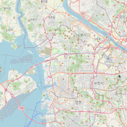
* [Raster tile layer (OSM)](https://maximkaaa.github.io/galileo/raster_tiles/)
* [Vector tile layer (Maplibre)](https://maximkaaa.github.io/galileo/vector_tiles/)
* Use buttons at the top to change the style of the map
* Click on any object to get information about it
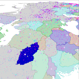
* [Feature layer](https://maximkaaa.github.io/galileo/feature_layers/)
* NOTE! Contains large dataset (~16 MB), might take some time to load
* Draws 250 countries' borders, consisting of ~4000 polygons with ~500K vertices, plus 40K city points
* Move mouse pointer to highlight any country, click on a country to write its name into console
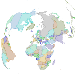
* [Map in Lambert Equal Area projection](https://maximkaaa.github.io/galileo/lambert/)
* Takes data set (country borders) in Mercator projection and draws it to the map in LAEA projection
* [Very many points](https://maximkaaa.github.io/galileo/many_points/)
* Enjoy 3.6 million points heat up your room with GPU.
# Overview
## General purpose
Architecture of **Galileo** is designed specifically to allow different modes of use:
* client GUI mapping applications
* server modules
* CLI tools
This does bring certain challenges and adds to complexity. For example, caching
of loaded and rendered objects works completely differently in server in client
applications. **Galileo** is designed in such a way as to allow the user of the
library to make all the relevant decisions and not to force one way.
It also does not make any assumptions about tile layer schemas, CRS and datums.
Feature layers support transparent re-projecting into the map CRS (support for
projecting tile layers is planned but not implemented yet).
## Cross-platform
At the moment Galileo uses `wgpu` backend to render the map. This means that
it can be used on any platform that `wgpu` supports:
* All major desktop platforms: Linux, MacOS, Windows
* Mobile platforms: Android, iOS
* Web though compiling to WASM (and using either WebGL or newer and cooler WebGPU)
Still, the backend is not integral part of the Galileo design, so we will probably
try other promising backends (like [vello](https://github.com/linebender/vello)).

## FFI
At this point, you can develop an application using Galileo only in Rust. But there is
a POC example of how we envision future development on other platforms: [wasm_examples/raster_tiles].
When all main features of Galileo are more or less stable (or when a need arises) we
will add FFI bindings to other languages using `wasm-bindgen` and `uniffi`. This will
allow you to create your applications in `JS`, `Kotlin`, `Swift` or `Python` using
common API.
## Features
Galileo is an active WIP, here is the list of the features that are already present:
* raster tile layers
* vector tile layers with styling
* vector geo-data layers (feature layers) with styling
* 3d view and 3d object rendering
* user-input handling on layers (mouse only at the moment, touch is WIP)
* support for different projections and tile schemes
* high performance
# Roadmap
There are so many things that we all want from mapping engine, but it's impossible to have
them all done at the same time. So here's our current plan and priorities:
### v0.1 - usabilitification
* Architecture and basic building blocks of the library
* Basic styling to be able to use Galileo for simple but useful applications
* Support main source types (TMS tiles, 2d geometries, MVT)
* Basic support for projections
### v0.2 - bueautification
* Advanced styling for features and vector tiles (image points, gradients, etc.)
* Support for more source and style formats
* Text label rendering
* Advanced feature layers (clusters, heatmaps, etc.)
### v0.3 - 3d-fication
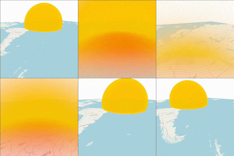
* 3d globe, atmosphere and stars around to make your dark hours brighter
* Terrain rendering to draw every mountain you climbed
* 3d models to put your house on those mountains
* Advanced support for projections and CRSs
# Running examples
Rust examples of using Galileo are located at [`galileo/examples`](galileo/examples). Refer to the [readme](galileo/examples/README.md)
for the list, description and run instructions.
## Web
There are also examples of running Galileo in a web-browser located at [`wasm_examples`](wasm_examples) folder. These are
excluded from the workspace (because Cargo does not like cross-platform workspaces).
To run those you will need to [install wasm-pack](https://rustwasm.github.io/wasm-pack/installer/):
```shell
wasm-pack build wasm_examples/countries --target no-modules --release
```
After that open `index.html` in your browser (must be served from `localhost`, use your
favourite developer server).
## Android
Check out [this example](android_examples/raster_tiles/README.md) to run Galileo on Android.
## Cross-compile from Linux to Windows
Install the target:
```shell
rustup target add x86_64-pc-windows-gnu
```
Install cross-linker. For Debian/Ubuntu:
```
sudo apt-get install mingw-w64
```
And then build it:
```shell
cargo build --target x86_64-pc-windows-gnu
```
# Sponsoring
There is still a lot of work to be done to make Galileo feature-full, production ready and useful for many. And we
would love to work on this full-time to bring this to you as soon as possible. So we are looking for sponsors
to make it possible.
Sponsor funds will help support maintainer's dedicated work and eventually fund freelance contributors.
If you think this library can be useful to you or someone you love, consider supporting its development. Sponsoring
comes with additional advantages:
* Increase development speed.
* Make your needs our priority.
* See your logo on the project's page.
# License
You can use this library without any worries as it is licensed under either of
* Apache License, Version 2.0 ([LICENSE-APACHE](LICENSE-APACHE) or http://www.apache.org/licenses/LICENSE-2.0)
* MIT license ([LICENSE-MIT](LICENSE-MIT) or http://opensource.org/licenses/MIT)
at your option.
# Contributing
Feature requests, pull requests, bug reports, comments, questions and discussion are welcome. Please, follow the code
of conduct when contributing.
Note, that since the library is still in early stages of development, any part may change at any moment. So before
starting any major undertaking with it or within it, open a discussion to sync your ideas with others' ideas.