https://github.com/blacklight/gpstracker
Read-only mirror of https://git.platypush.tech/blacklight/gpstracker
https://github.com/blacklight/gpstracker
Last synced: 7 months ago
JSON representation
Read-only mirror of https://git.platypush.tech/blacklight/gpstracker
- Host: GitHub
- URL: https://github.com/blacklight/gpstracker
- Owner: blacklight
- License: gpl-3.0
- Created: 2025-02-27T23:15:33.000Z (over 1 year ago)
- Default Branch: main
- Last Pushed: 2025-03-10T01:33:43.000Z (over 1 year ago)
- Last Synced: 2025-03-19T05:14:21.229Z (over 1 year ago)
- Language: Vue
- Size: 344 KB
- Stars: 0
- Watchers: 1
- Forks: 0
- Open Issues: 0
-
Metadata Files:
- Readme: README.md
- License: LICENSE
Awesome Lists containing this project
README
# GPSTracker
[](https://ci-cd.platypush.tech/blacklight/gpstracker)
##### Track your GPS data, from any data source
- [Features](#features)
* [History navigation](#history-navigation)
* [Select location points by area](#select-location-points-by-area)
* [Advanced statistics](#advanced-statistics)
- [Configuration](#configuration)
- [Docker installation](#docker-installation)
- [Local installation](#local-installation)
* [Build](#build)
* [Run](#run)
- [Usage](#usage)
* [Initial setup](#initial-setup)
* [Ingestion](#ingestion)
+ [Enriching location data](#enriching-location-data)
* [External data sources](#external-data-sources)
- [Development](#development)
* [Compile and Hot-Reload for Development](#compile-and-hot-reload-for-development)
+ [Backend](#backend)
+ [Frontend](#frontend)
GPSTracker is a simple Webapp that consists of:
- A backend that:
- Can manage GPS data stored on a local db or on any compatible data source
(supported: `postgres`, `mysql`, `mariadb`, `mongodb`, `sqlite`,
`snowflake`), with arbitrary complex filtering, and expose them over a
simple Web API.
- Can ingest GPS location updates from HTTP.
- A frontend to display GPS data points and provides advanced filtering.
It is meant as a self-hosted and privacy-aware alternative to services like Google Maps Timeline.
## Features
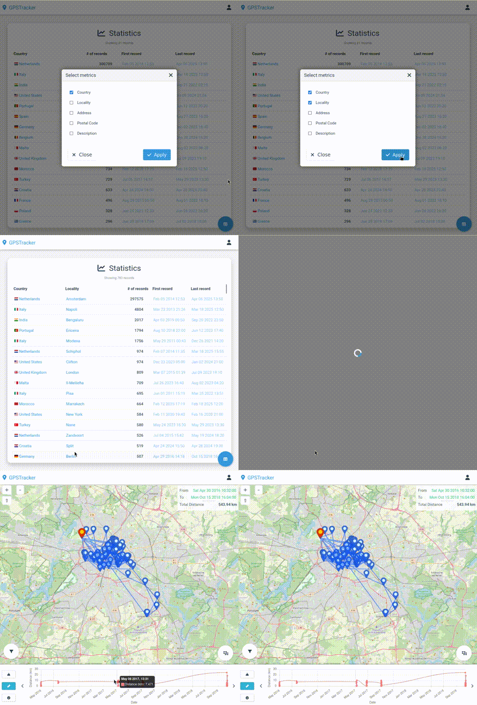
### History navigation
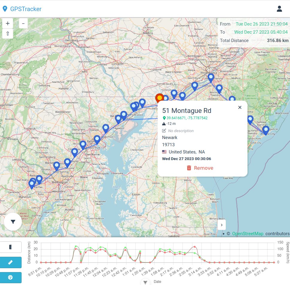
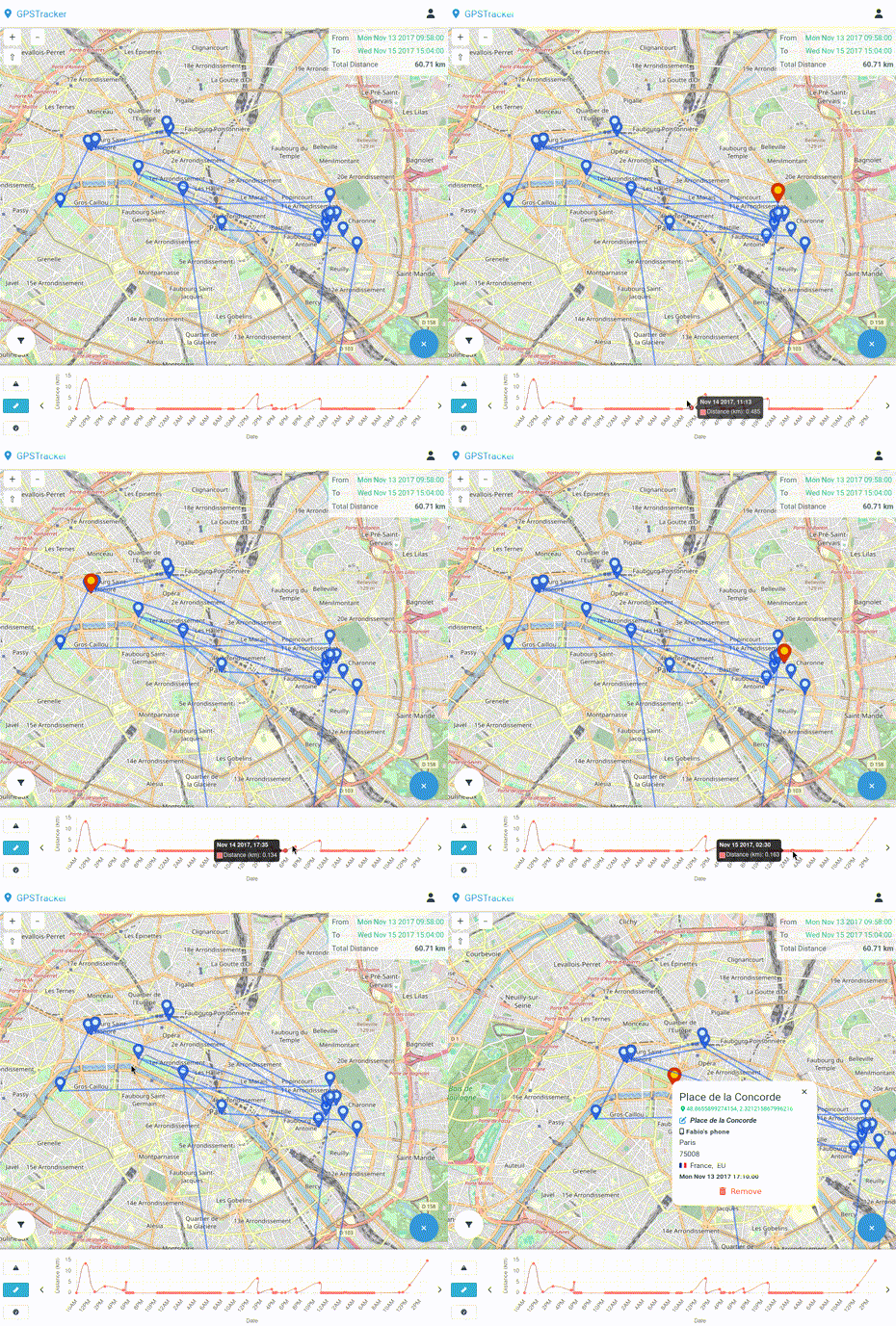
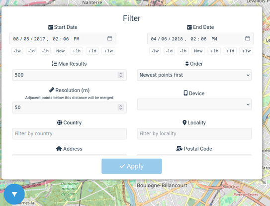
At its core GPSTracker allows you to easily navigate through your stored
location data, offering pagination, advanced filtering and sorting.
The timeline allows an easy time-based navigation, and it also reports
information such as the total distance traveled, the altitude, the speed and the
battery level at the time of the location point.
### Select location points by area
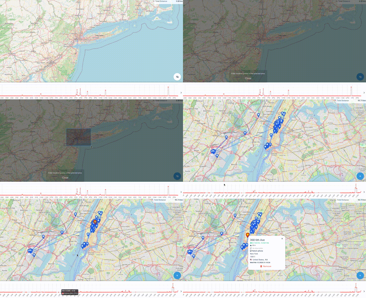
You can select a specific area on the map and filter the location points by it,
providing easy answers to questions such as "where have I been in this specific
location in the last year?".
### Advanced statistics
More advanced statistics are available in the _Stats_ page, which allows you to
aggregate your location data by any combinations of the available metrics and
explore specific location points in a certain group.
## Configuration
```
cp .env.example .env
```
See [the provided `.env.example`](./.env.example) for a reference.
## Docker installation
```sh
docker compose up
```
## Local installation
### Build
Requirements:
- `node`
- `typescript`
- `make`
```sh
make
```
Or, if you want to build the backend and the frontend separately:
```sh
# Backend
make backend
# Frontend
make frontend
```
### Run
```sh
npm run start
```
## Usage
### Initial setup
Once the application is running, you can access the frontend at
`http://localhost:3000` - or on whatever port you configured in the `.env`
file.
Use the `ADMIN_EMAIL` and `ADMIN_PASSWORD` values from the `.env` file to log
in.
You can then create a new device for your GPS data under the `Devices` menu, or
at `http://localhost:3000/devices`. Take note of the `deviceId`, you will need
it to ingest data.
Then create a new API token from the `API` menu, or at
`http://localhost:3000/api`.
### Ingestion
The application exposes a POST endpoint at `/gpsdata` that accepts a JSON
payload containing the GPS data to ingest. Example:
```bash
curl -XPOST \
-H "Authorization: Bearer your-api-token" \
-H "Content-Type: application/json"
-d '[{
"deviceId": "your-device-id",
"latitude": 40.7128,
"longitude": -74.0060,
"address": "260 Broadway",
"locality": "New York, NY",
"country": "us",
"postalCode": "10007",
"description": "New York City Hall",
"timestamp": "2021-01-01T00:00:00Z"
}]' http://localhost:3000/api/v1/gpsdata
```
You can wrap this in a script to ingest data from a file, or from a GPS tracker.
You can also configure a mobile app like [GPSLogger](https://gpslogger.app/) to
periodically send data to the endpoint - select _Custom URL_ and use the
`/gpsdata` endpoint with the API token as the `Authorization` header under the
_HTTP Headers_ section.
Or, for more advanced use cases, you can use a general-purpose application like
[Tasker](https://tasker.joaoapps.com/) in combination with
[AutoLocation](https://play.google.com/store/apps/details?id=com.joaomgcd.autolocation)
to send data to the endpoint, or decouple the ingestion from the frontend by
using an intermediate MQTT or Kafka broker.
#### Enriching location data
If the ingested location data does not contain the `address`, `locality`,
`country` or `postalCode` fields, and you have set the `GEOCODE_PROVIDER`
environment variable, then the application will try to geocode the location
upon ingestion using the configured geocoding provider. Supported providers:
- [`nominatim`](https://nominatim.org/)
- It uses OpenStreetMap data ([usage
policy](https://operations.osmfoundation.org/policies/nominatim/)).
- It doesn't require an API key, but it is rate-limited to 1 request per
second (not advised if you are ingesting bulk data if you use the
default `NOMINATIM_URL` instance).
- It supports a custom `NOMINATIM_URL` environment variable to use a custom
Nominatim instance.
- [`google`](https://developers.google.com/maps/documentation/geocoding/start)
- It requires a Google Maps API key, set in the `GOOGLE_API_KEY` environment
variable.
- See [additional usage
limits](https://developers.google.com/maps/documentation/geocoding/usage-and-billing)
for details. You can set your own usage limits in the Google Cloud
console, but keep in mind that above a certain threshold you will be
charged.
If `GEOCODE_PROVIDER` is not set, the application will not attempt to geocode
the location data upon ingestion.
### External data sources
By default, the application will store the GPS data under the configured
`DB_URL` database.
If you have an existing database with GPS data, you can configure it in the
`.env` file through the `DB_LOCATION_URL` variable. The application will then
read the data from the external source and expose it through the API.
Consult the `.env.example` file if the column names in your database differ from
the default ones.
Note however that:
- The external data source must have a `deviceId` column (or whatever column
name you configured in the `.env` file) that uniquely identifies the device
that generated the data, and it must point to a valid device in the
application database.
- Changes to the ownership of the devices or deletion of devices in the
application database will not be reflected in the external data source.
## Development
### Compile and Hot-Reload for Development
#### Backend
```sh
npm run dev
```
#### Frontend
```sh
cd frontend
npm run dev
```