https://github.com/engineervix/91ecd3d2db423b0c4f0dc77e094e9cd01b34
https://github.com/engineervix/91ecd3d2db423b0c4f0dc77e094e9cd01b34
Last synced: about 1 year ago
JSON representation
- Host: GitHub
- URL: https://github.com/engineervix/91ecd3d2db423b0c4f0dc77e094e9cd01b34
- Owner: engineervix
- License: mit
- Created: 2024-08-28T16:47:35.000Z (almost 2 years ago)
- Default Branch: main
- Last Pushed: 2024-08-29T08:37:56.000Z (almost 2 years ago)
- Last Synced: 2025-03-29T11:41:33.285Z (over 1 year ago)
- Language: Python
- Size: 931 KB
- Stars: 0
- Watchers: 1
- Forks: 0
- Open Issues: 2
-
Metadata Files:
- Readme: README.md
- Changelog: CHANGELOG.md
- Contributing: docs/contributing.md
- License: LICENSE
- Security: SECURITY.md
- Support: docs/supported-geocoders.md
Awesome Lists containing this project
README
[](https://github.com/Frojd/wagtail-geo-widget/actions/workflows/main.yml) [](https://badge.fury.io/py/wagtailgeowidget)
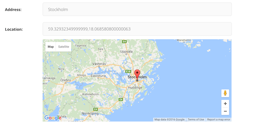
# Wagtail-Geo-Widget
Wagtail-Geo-Widget is the complete map solution for your Wagtail site.
## Features
- Supports Google Maps or any tile provider supported by Leaflet (such as Open Street Map or Mapbox)
- Real spatial support (with GeoDjango and PointField)
- Storing coordinates as strings (for no-GeoDjango setups)
- StreamField integration
- Searching with geocoding (supports Google Geocoding, Nominatim and Mapbox)
- Inline panel support
- Optional address search field
- Language support
## Documentation
- [Getting started with Google Maps](https://github.com/Frojd/wagtail-geo-widget/blob/main/docs/getting-started-with-google-maps.md)
- [Getting started with Leaflet](https://github.com/Frojd/wagtail-geo-widget/blob/main/docs/getting-started-with-leaflet.md)
- [Settings](https://github.com/Frojd/wagtail-geo-widget/blob/main/docs/settings.md)
- [Adding the widget to a Page](https://github.com/Frojd/wagtail-geo-widget/blob/main/docs/adding-to-a-page.md)
- [Integrating with GeoDjango](https://github.com/Frojd/wagtail-geo-widget/blob/main/docs/integrating-with-geodjango.md)
- [Adding to a StreamField](https://github.com/Frojd/wagtail-geo-widget/blob/main/docs/adding-to-a-streamfield.md)
- [Supported Geocoders](https://github.com/Frojd/wagtail-geo-widget/blob/main/docs/supported-geocoders.md)
- [FAQ](https://github.com/Frojd/wagtail-geo-widget/blob/main/docs/faq.md)
## Contribute
If you have ideas for improvement, please share your thoughts through an issue.
- Issue Tracker: [https://github.com/Frojd/wagtail-geo-widget/issues](https://github.com/Frojd/wagtail-geo-widget/issues)
- Source Code: [https://github.com/Frojd/wagtail-geo-widget](https://github.com/Frojd/wagtail-geo-widget)
- [Contribution documentation](https://github.com/Frojd/wagtail-geo-widget/blob/main/docs/contributing.md)
We also welcome Pull Requests (PR). Please note that this project uses git-flow so please use the `develop` branch when creating PR's.
## Security
If you believe you have found a security issue with any of our projects please email us at [security@frojd.se](security@frojd.se).
## License
Wagtail-Geo-Widget is released under the [MIT License](http://www.opensource.org/licenses/MIT).