https://github.com/esri/arcgis-maps-sdk-dotnet-toolkit
Toolkit for ArcGIS Maps SDK for .NET
https://github.com/esri/arcgis-maps-sdk-dotnet-toolkit
arcgis-runtime-sdk csharp native-development toolkit uwp wpf xamarin xamarin-android xamarin-forms xamarin-ios xaml
Last synced: about 1 year ago
JSON representation
Toolkit for ArcGIS Maps SDK for .NET
- Host: GitHub
- URL: https://github.com/esri/arcgis-maps-sdk-dotnet-toolkit
- Owner: Esri
- License: apache-2.0
- Created: 2013-07-17T17:15:59.000Z (almost 13 years ago)
- Default Branch: main
- Last Pushed: 2025-05-13T17:21:43.000Z (about 1 year ago)
- Last Synced: 2025-05-13T17:21:55.511Z (about 1 year ago)
- Topics: arcgis-runtime-sdk, csharp, native-development, toolkit, uwp, wpf, xamarin, xamarin-android, xamarin-forms, xamarin-ios, xaml
- Language: C#
- Homepage: https://esri.github.io/arcgis-maps-sdk-dotnet-toolkit/
- Size: 6.53 MB
- Stars: 229
- Watchers: 43
- Forks: 124
- Open Issues: 34
-
Metadata Files:
- Readme: README.md
- Contributing: CONTRIBUTING.md
- License: license.txt
Awesome Lists containing this project
README
[](https://developers.arcgis.com)
[](https://developers.arcgis.com/net/)
[](https://developers.arcgis.com/net/wpf/sample-code/)
[](https://www.nuget.org/packages?q=ArcGIS+Runtime+Templates)
[](https://www.nuget.org/profiles/Esri_Inc)
[](https://community.esri.com/t5/net-maps-sdk-questions/bd-p/arcgis-runtime-sdk-dotnet-questions)
# ArcGIS Maps SDK for .NET Toolkit
The ArcGIS Maps SDK for .NET Toolkit contains controls and components to accelerate your development with [ArcGIS Maps SDK for .NET](https://developers.arcgis.com/net/).
> **Note**: Starting at version 200.0, Toolkit assemblies are now built individually for each platform. Please replace any existing `Esri.ArcGISRuntime.Toolkit` NuGet reference with Toolkit NuGet package specific to that platform. For example if you have a WPF application using Toolkit, you will need to uninstall `Esri.ArcGISRuntime.Toolkit` NuGet package and add `Esri.ArcGISRuntime.Toolkit.WPF` NuGet package.
# Documentation
[](docs/controls.md)
## Features
| Component | Screenshot | Description | Availability |
|-----------|------------|-------------|--------------|
|[BasemapGallery](docs/basemap-gallery.md) |  | Display a list or grid of Basemaps. | WinUI, MAUI, UWP, WPF |
|[BookmarksView](docs/bookmarks-view.md) | 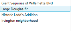 | Show and navigate to bookmarks from a map or a custom list. | WinUI, MAUI, UWP, WPF |
| [Compass](docs/compass.md) |  | Show a compass direction when the map or scene is rotated. | WinUI, MAUI, UWP, WPF |
| [FeatureDataField](docs/feature-data-field.md) | 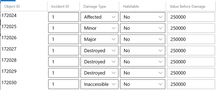 | Display and optionally allow editing of a single field attribute of a feature. | UWP, WPF |
|[FeatureFormView](docs/featureformview.md) |  | Generates an interactive form. | MAUI, WPF |
|[FloorFilter](docs/floor-filter.md) |  | Browse floor-aware maps and scenes and filter the view to show levels in a facility. | WinUI, MAUI, UWP, WPF |
|[GeoViewController](docs/geoviewcontroller.md) | | A helper class to enable easy adoption of MVVM patterns in an ArcGIS Maps SDK for .NET application. | WinUI, MAUI, UWP, WPF |
| [Legend](docs/legend.md) |  | Display a legend for a map or scene view. | WinUI, MAUI, UWP, WPF |
| [MeasureToolbar](docs/measure-toolbar.md) |  | Measure distances, areas, and features in a map view. | WinUI, UWP, WPF |
|[OverviewMap](docs/overview-map.md) |  | Display an interactive inset map for a map or scene. | WinUI, MAUI, UWP, WPF |
|[PopupViewer](docs/popup-viewer.md) |  | Displays information from simple popups. | WinUI, MAUI, UWP, WPF |
| [ScaleLine](docs/scale-line.md) |  | Display the current scale reference for a map. | WinUI, MAUI, UWP, WPF |
|[SearchView](docs/search-view.md) |  | Search using one or more locators, with support for suggestions, automatic zooming, and custom search sources. | WinUI, MAUI, UWP, WPF |
| [SymbolDisplay](docs/symbol-display.md) |  | Render a symbol in a control. | WinUI, MAUI, UWP, WPF |
|[TimeSlider](docs/time-slider.md) |  | Interactively manipulate or animate the time extent for a map or scene. | WinUI, UWP, WPF |
|[UtilityNetworkTraceTool](docs/un-trace.md) | 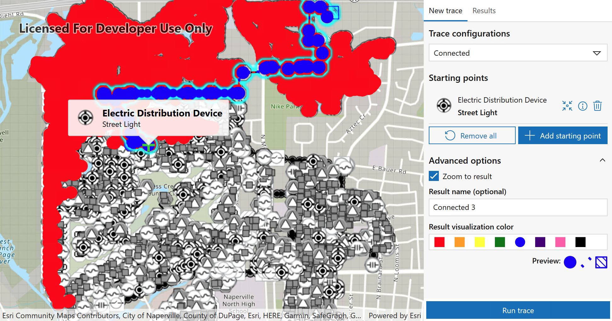 | Use named trace configurations defined in a web map to perform connected trace operations and compare results. | WPF, UWP, WinUI, MAUI |
## Get started
The simplest way to get started is to add the platform-specific NuGet package(s) to your projects:
- WPF: `Esri.ArcGISRuntime.Toolkit.WPF`
- WinUI: `Esri.ArcGISRuntime.Toolkit.WinUI`
- UWP: `Esri.ArcGISRuntime.Toolkit.UWP`
- MAUI: `Esri.ArcGISRuntime.Toolkit.Maui`
## Customize
The ArcGIS Maps SDK for .NET Toolkit is provided as an open-source project so you can customize it for your requirements. [See the docs](https://esri.github.io/arcgis-maps-sdk-dotnet-toolkit/buildingtoolkit.html) for instructions on building the Toolkit yourself.
## Compatibility
Nuget packages for Toolkit are tested and published in sync with the `Esri.ArcGISRuntime.*` packages. Toolkit is only supported when used with the matching ArcGIS Maps SDK for .NET API version.
## Contribute
Anyone and everyone is welcome to [contribute](CONTRIBUTING.md).
Toolkit is provided as an open source project to enable you to customize for your requirements. [See the docs](https://esri.github.io/arcgis-maps-sdk-dotnet-toolkit/buildingtoolkit.html) for instructions on building the Toolkit yourself.
Find a bug or want to request a new feature? Please let us know by [submitting an issue](https://esri.github.io/arcgis-maps-sdk-dotnet-toolkit/issues/new).
## License
Copyright © 2014-2022 Esri.
Licensed under the Apache License, Version 2.0 (the "License");
you may not use this file except in compliance with the License.
You may obtain a copy of the License at
https://www.apache.org/licenses/LICENSE-2.0
Unless required by applicable law or agreed to in writing, software
distributed under the License is distributed on an "AS IS" BASIS,
WITHOUT WARRANTIES OR CONDITIONS OF ANY KIND, either express or implied.
See the License for the specific language governing permissions and
limitations under the License.
A copy of the license is available in the repository's [license.txt](/license.txt) file.