https://github.com/genericmappingtools/dcw-gmt
Data and scripts that maintain and build the DCW data used in GMT
https://github.com/genericmappingtools/dcw-gmt
Last synced: 12 months ago
JSON representation
Data and scripts that maintain and build the DCW data used in GMT
- Host: GitHub
- URL: https://github.com/genericmappingtools/dcw-gmt
- Owner: GenericMappingTools
- License: lgpl-3.0
- Created: 2020-01-03T00:36:45.000Z (over 6 years ago)
- Default Branch: master
- Last Pushed: 2024-06-25T12:31:41.000Z (about 2 years ago)
- Last Synced: 2024-06-25T13:31:42.459Z (about 2 years ago)
- Language: Shell
- Homepage:
- Size: 221 MB
- Stars: 7
- Watchers: 10
- Forks: 2
- Open Issues: 3
-
Metadata Files:
- Readme: README.md
- Changelog: ChangeLog
- Contributing: CONTRIBUTING.md
- License: LICENSE
Awesome Lists containing this project
README
# DCW-GMT: The Digital Chart of the World for GMT


This repository contains the data and scripts that maintain and build
the dcw-gmt package used by **GMT 5 or later**. **Note**: DCW 2.0.1
requires GMT 6.1.1 or later. Building the DCW netCDF database requires
the netCDF executables *ncgen* and *nccopy*, usually available in a port
called *netcdf-bin* or similar (i.e, separate from the netCDF library).
This README contains the documentation for DCW. For information about building
and modifying DCW, please refer to the [contributing guide](CONTRIBUTING.md).
## About
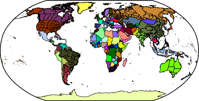
The Digital Chart of the World is a comprehensive 1:1,000,000 scale
vector basemap of the world. The charts were designed to meet the needs
of pilots and air crews in medium- and low-altitude en route navigation
and to support military operational planning, intelligence briefings,
and other needs. For basic background information about DCW, see the
[Wikipedia entry](http://en.wikipedia.org/wiki/Digital_Chart_of_the_World).
DCW-GMT is an enhancement to DCW in a few ways:
1. It contains more state boundaries (the largest 8 countries, Great Britain and Norway are now represented).
2. The data have been reformatted to save space and are distributed as a single deflated netCDF-4 file.
## Download
You can download the latest dcw-gmt package from
[GitHub releases](https://github.com/GenericMappingTools/dcw-gmt/releases)
or from the [GMT main site](https://www.generic-mapping-tools.org/download/).
## Usage
DCW-GMT is an optional install for GMT and its wrappers. If you did install it
then you can access the DCW data for plotting or analysis via GMT's
[coast](https://docs.generic-mapping-tools.org/latest/coast.html) module. You
can also use the [ISO 2-character codes](https://en.wikipedia.org/wiki/ISO_3166-1_alpha-2)
for countries as a way to specify map domains via the **-R** option. For
instance, to make a map showing France with a region rounded to the nearest 2
degrees in longitude and latitude, you can run:
gmt coast -RFR+r2 -Glightgray -B -pdf france
If in addition you want to paint the landmass of France blue, you can run:
gmt coast -RFR+r2 -Glightgray -B -EFR+gblue -pdf france
To access states without countries you must use the *country.state* syntax. See
the [coast](https://docs.generic-mapping-tools.org/latest/coast.html)
documentation for details. For instance, to make a map of the US and show Texas
and Mississippi as red states, try:
gmt coast -RUS+r2 -Glightgray -B -EUS.TX,US.MS+gred -pdf us
### DCW Collections
From versions 2.1.0 and GMT 6.4.0 onwards you can also use named regions (continents, seas, etc) using their names.
We offer 37 geographic regions based on [Natural Earth](https://www.naturalearthdata.com) at scale 1:110, 104 seas
named (102 based on [IHO1953](https://epic.awi.de/id/eprint/29772/1/IHO1953a.pdf), most of them taken from
[Fourcy and Lorvelec (2013)](https://www6.rennes.inrae.fr/ese_eng/HRMLOS)) and 57 lakes, islands and archipelagoes.
You can also use 46 collections of countries; 30 are from [UN49](https://unstats.un.org/unsd/methodology/m49/)
and the rest were obtained from from [Wikipedia](https://en.wikipedia.org/wiki/Subregion).
You can see the full list at [dcw-collections.txt](dcw-collections.txt).
These allow you to make maps matching those regions, such as
gmt coast -RScandinavia -Glightgray -B -pdf Scandinavia
gmt coast -RIHO28 -Glightgray -B -pdf MediterraneanSea
gmt coast -RSAM -Glightgray -B -pdf SouthAmerica
gmt coast -RHMLY -Glightgray -B -pdf Himalayas
## Notes
If you are building GMT from source then you should set the parameter
**DCW_ROOT** in the *cmake/ConfigUser.cmake* to point to the directory where
*dcw-gmt.nc* has been placed. If you add this file after GMT installation
was completed then you can always have GMT find it by placing it in your
user *~/.gmt* directory or by setting the **DIR_DCW** parameter in the
*gmt.conf* settings.
## Changelog
The detailed changelog is available [here](ChangeLog).
## License
The project is distributed under the
[GNU Lesser General Public License](http://www.gnu.org/licenses/lgpl-3.0.html).