https://github.com/incubated-geek-cc/tableau-data-utility
A browser web application which uses d3.js v4 to generate tableau readable datasets for network graph visualisations.
https://github.com/incubated-geek-cc/tableau-data-utility
adjustment basemap geojson gis hex-maps map network-graph tableau webapp
Last synced: over 1 year ago
JSON representation
A browser web application which uses d3.js v4 to generate tableau readable datasets for network graph visualisations.
- Host: GitHub
- URL: https://github.com/incubated-geek-cc/tableau-data-utility
- Owner: incubated-geek-cc
- Created: 2020-10-01T07:17:04.000Z (almost 6 years ago)
- Default Branch: master
- Last Pushed: 2025-03-01T14:06:44.000Z (over 1 year ago)
- Last Synced: 2025-03-01T14:22:44.022Z (over 1 year ago)
- Topics: adjustment, basemap, geojson, gis, hex-maps, map, network-graph, tableau, webapp
- Language: JavaScript
- Homepage: https://tableau-data-utility.onrender.com/
- Size: 7.6 MB
- Stars: 2
- Watchers: 1
- Forks: 0
- Open Issues: 0
-
Metadata Files:
- Readme: README.md
Awesome Lists containing this project
README
# Tableau Data Utility
## Objective: Making Tableau users' lives easier in data preparation for data visualisation
### View [app demo](https://tableau-data-utility.onrender.com/) (Note that the Heroku site has been sunset.)
### General Functionalities
* Input user's data file(s)
* Export of generated transformed data files
### 1. Generate Network Graph Data for Tableau
Adjustment specific position of nodes to alter network graph layout
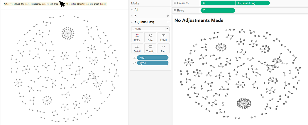
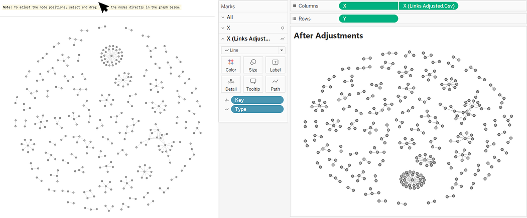
**Demo:**

**Before Adjustment:**
**After Adjustment:**
---
Adjustment of d3 network graph layout parameters: `size` `distance` `strength` `collide`
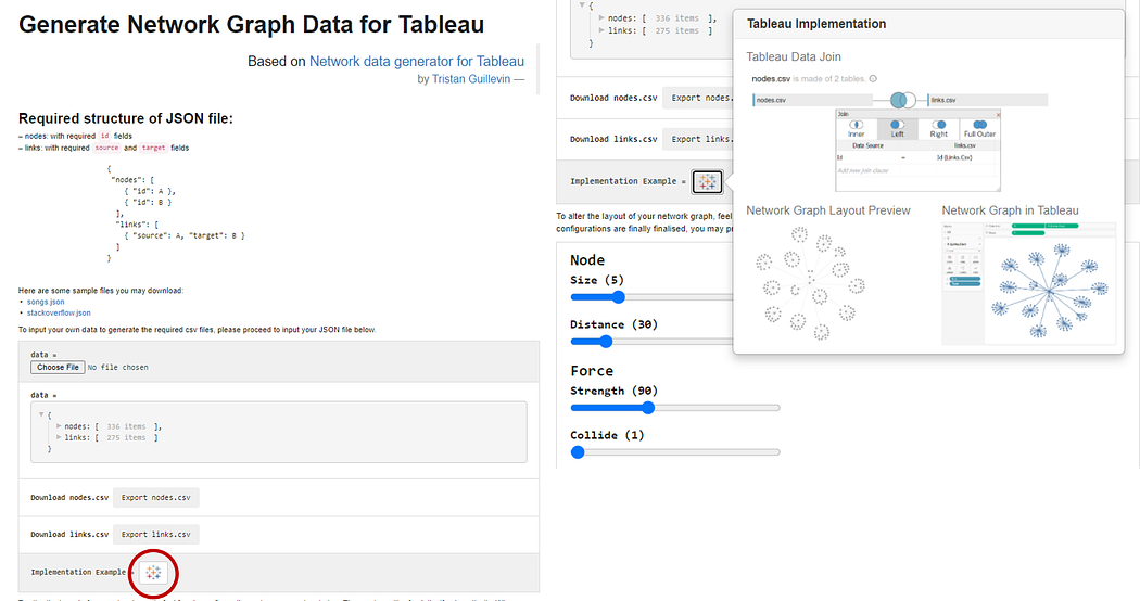
More information found at [Leverage on D3.js v4 to build a Network Graph for Tableau with ease](https://towardsdatascience.com/leverage-on-d3-js-v4-to-build-a-network-graph-for-tableau-with-ease-cc274cba69ce)
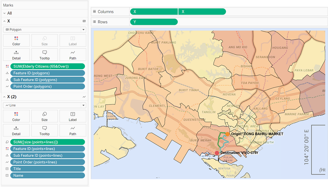
### 2. Generate Spatial Data for Tableau
Map Polygons in Tableau with CSV Output File:

---
Transform GeoJSON to CSV to visualise mixed-geometry types in Tableau in a single setting:
---
Export required basemap with coordinates auto-generated:
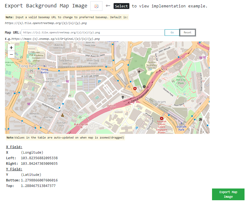
---
Input basemap image and coordinates:
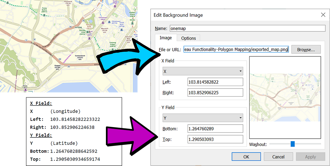
---
Basemap has been imported into Tableau:

---
Convert spatial files SHP & KML to GeoJSON format:

More information found at [Underrated Combined Functionalities of Tableau — Point, LineString & Polygon Mapping](https://towardsdatascience.com/underrated-combined-functionalities-of-tableau-point-linestring-polygon-mapping-b4c0568a4de2)
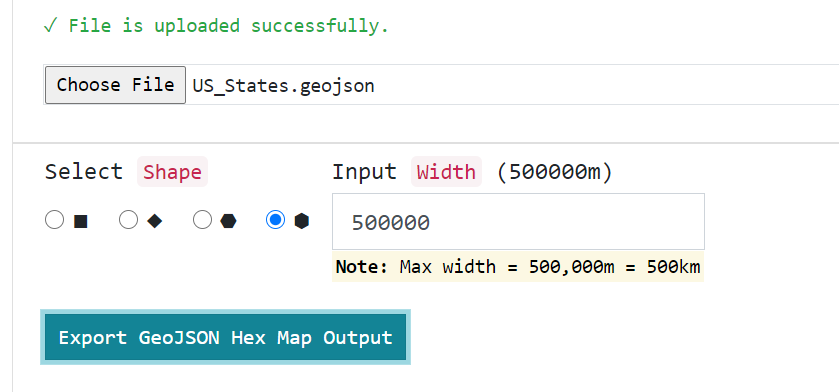
### 3. Generate Hex Maps Data for Tableau
Toggle Parameters for Hex Map generated by final GeoJSON output:
---
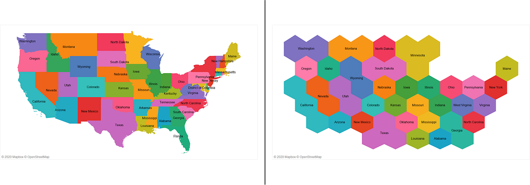
Output GeoJSON file rendering Hex Maps:
---
Convert spatial files SHP & KML to GeoJSON format:

More information found at [Generate Hex Maps from your existing Spatial Data in less than 3 steps](https://geek-cc.medium.com/generate-hex-maps-from-your-existing-spatial-data-in-less-than-3-steps-a6f39d778d84)