Ecosyste.ms: Awesome
An open API service indexing awesome lists of open source software.
https://github.com/intgr/histonia
High-resolution tiles of Estonian aerial photo maps
https://github.com/intgr/histonia
estonia mapproxy maps openstreetmap
Last synced: about 1 month ago
JSON representation
High-resolution tiles of Estonian aerial photo maps
- Host: GitHub
- URL: https://github.com/intgr/histonia
- Owner: intgr
- License: mit
- Created: 2021-06-16T21:26:16.000Z (over 3 years ago)
- Default Branch: main
- Last Pushed: 2023-12-14T23:19:36.000Z (about 1 year ago)
- Last Synced: 2024-10-31T18:06:20.898Z (3 months ago)
- Topics: estonia, mapproxy, maps, openstreetmap
- Language: Dockerfile
- Homepage:
- Size: 24.4 KB
- Stars: 3
- Watchers: 3
- Forks: 0
- Open Issues: 0
-
Metadata Files:
- Readme: README.md
- License: LICENSE
Awesome Lists containing this project
README
HiStonia
========
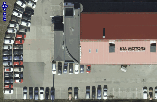
HiStonia is a [MapProxy](https://mapproxy.org/) configuration for serving up
**high-resolution tiles** from Estonian Maa-amet (Land Board) aerophoto maps
and LIDAR maps, which you can use as imagery in the **OpenStreetMap iD editor**.
High-resolution tiles and LIDAR tiles are available from Maa-amet's WMS servers,
but the iD editor only supports the TMS (Tile Map Service) protocol, not WMS.
This MapProxy configuration provides a TMS service and converts back and forth
between WMS.
### Usage
It's easiest to get started with Docker. The following will work on Linux and macOS:
```shell
DOCKER_BUILDKIT=1 docker build -t histonia .
docker run -it --rm --name=histonia -p 127.0.0.1:8080:8080 histonia
```
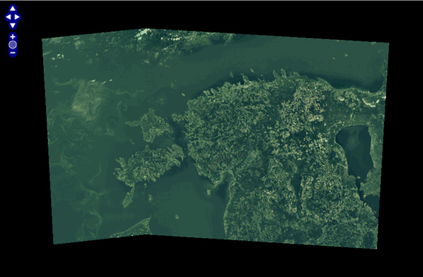
Once that is running, you can use the built-in demo:
http://localhost:8080/demo/?tms_layer=xgis&format=png&srs=EPSG%3A3857
You should see a map of Estonia!
[ ](https://raw.githubusercontent.com/intgr/static/master/histonia/histonia-demo.png)
#### Configure iD editor
To use in the iD editor, open "Background Settings", choose "Custom".
Click on the "•••" next to "Custom" and enter the following URL:
```
http://localhost:8080/tiles/xgis/hidpi/{zoom}/{x}/{y}.png
```
### LIDAR maps
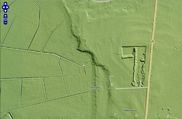
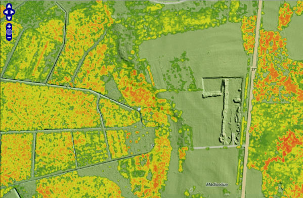
There are two maps derived from LIDAR surveys.
| Terrain (DTM) | Surface (DSM) |
| ------------- | ------------- |
| [ ](https://raw.githubusercontent.com/intgr/static/master/histonia/histonia-terrain-01.png) | [
 ](https://raw.githubusercontent.com/intgr/static/master/histonia/histonia-terrain-surface-01.png) |
Digital Terrain Model (DTM) - represents the bare ground surface without any
objects like plants and buildings:
* Demo: http://localhost:8080/demo/?tms_layer=xgis_terrain&format=png&srs=EPSG:3857
* URL for iD editor: `http://localhost:8080/tiles/xgis_terrain/hidpi/{zoom}/{x}/{y}.png`
Digital Surface Model (DSM), overlaid on top of DTM - represents the surface
with objects like buildings and trees. Note: The surface layer is only visible
at higher zoom levels.
* Demo: http://localhost:8080/demo/?tms_layer=xgis_surface&format=png&srs=EPSG:3857
* URL for iD editor: `http://localhost:8080/tiles/xgis_surface/hidpi/{zoom}/{x}/{y}.png`
### Is this allowed?
Yes, Maa-amet has issued an official permission to OpenStreetMap:
https://svimik.com/Maa-amet_vastus_OSM.pdf
For non-OpenStreetMap-related uses, see the open data license:
https://geoportaal.maaamet.ee/docs/Avaandmed/ETAK_ruumiandmete_litsentsileping.pdf
Many public Maa-amet services are documented here:
https://geoportaal.maaamet.ee/est/Teenused/WMSWFS-teenused-p65.html
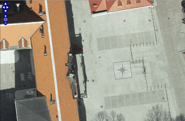
### Gallery
[ ](https://raw.githubusercontent.com/intgr/static/master/histonia/histonia-01.png)
[ ](https://raw.githubusercontent.com/intgr/static/master/histonia/histonia-02.png)
[ ](https://raw.githubusercontent.com/intgr/static/master/histonia/histonia-03.png)