https://github.com/jakebrehm/geophotos
🗺 📍 A Python package to pull, analyze, and plot coordinates from various sources.
https://github.com/jakebrehm/geophotos
data-visualization gdal geopandas heatmap osgeo photos plot plotting python python-3
Last synced: 3 days ago
JSON representation
🗺 📍 A Python package to pull, analyze, and plot coordinates from various sources.
- Host: GitHub
- URL: https://github.com/jakebrehm/geophotos
- Owner: jakebrehm
- License: mit
- Created: 2019-09-07T03:08:03.000Z (almost 7 years ago)
- Default Branch: master
- Last Pushed: 2020-08-14T01:43:13.000Z (almost 6 years ago)
- Last Synced: 2026-05-05T12:17:46.163Z (about 1 month ago)
- Topics: data-visualization, gdal, geopandas, heatmap, osgeo, photos, plot, plotting, python, python-3
- Language: Python
- Homepage:
- Size: 72.4 MB
- Stars: 0
- Watchers: 1
- Forks: 0
- Open Issues: 0
-
Metadata Files:
- Readme: readme.md
- License: LICENSE.txt
Awesome Lists containing this project
README

Making handling coordinates a breeze.


# What is **GeoPhotos**?
**GeoPhotos** is a Python library designed to make it easy to pull coordinates
from various sources, analyze them in order to obtain useful information, and
plot them on a map.
## Main features
An overview of some of the major features of **GeoPhotos** are as follows:
* Extract metadata (timestamp, coordinates, etc.) from one or more files, and
write to a csv file if desired
* Pull coordinates from Google Takeout location history
* Plot coordinate data on a fully customizable heatmap, including markers,
tooltips, layer control, and more
* Analyze coordinate data to determine unique countries, most common countries,
and more
* Highlight certain countries on the heatmap easily and painlessly
* Save the map to an html file for reference or for use with web development
frameworks such as *flask*
* Open the html file directly from the code for debugging
# How to get it
## Dependencies
### Required dependencies
Currently, the following packages are required:
* [pillow](https://github.com/python-pillow/Pillow)
* [folium](https://github.com/python-visualization/folium)
* [osgeo](https://github.com/OSGeo/gdal)
Some packages that are currently required may be made optional in the future,
such as the [gdal/osgeo](https://github.com/OSGeo/gdal) package.
### Optional Dependencies
The [geopandas](https://github.com/geopandas/geopandas) package has been made
optional due to how difficult it is to install properly. It is required to
perform geographical data analysis.
## Installation
Assuming you've already got the dependencies covered, you can use pip to install
this package:
```
pip install geophotos
```
However, you will most likely run into problems doing it this way.
Unfortunately, I have tried and failed to overcome these obstacles myself.
My recommendation is to install geopandas using Anaconda/conda (you might have
to install *gdal* as well), and then pip install it into your current environment:
```
conda install geopandas
conda install gdal
pip install geophotos
```
This should handle all of the dependencies for you, although you still might run
into some issues (I sure did!).
## Updating
To update *geophotos* to the latest version, simply use the command:
```
pip install --upgrade geophotos
```
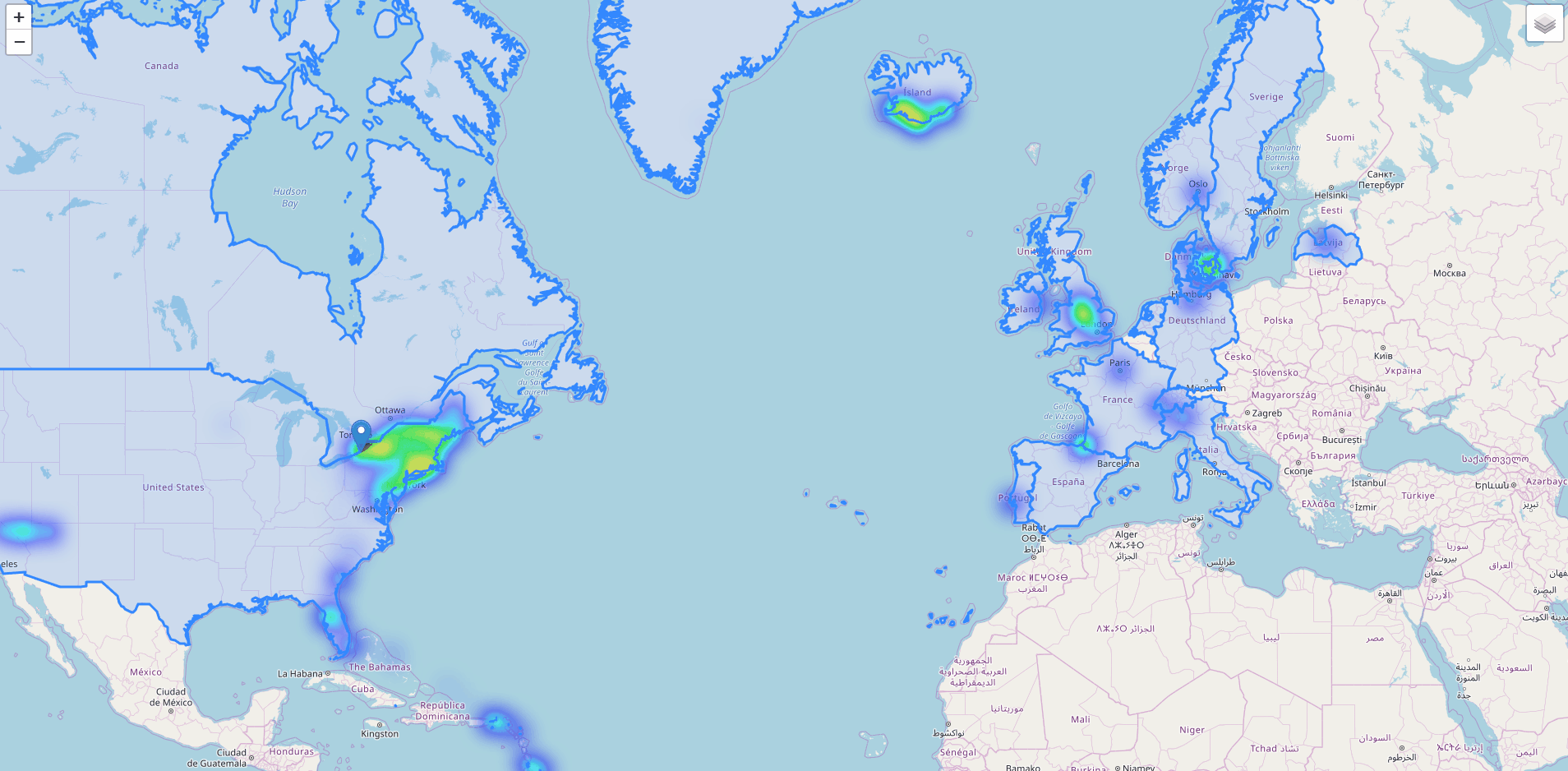
# Example usage
## Heatmap from photo locations
One of the main reasons I made this package was to pull GPS information from the
pictures in my iCloud library, then plot them on a map. Skipping the pulling of
the coordinates for simplicity's sake, the following code does the following:
1. Read latitudes and longitudes from a csv file
2. Generate a heatmap using this coordinate data
3. Add a marker that marks my hometown
4. Analyze the data and determine which countries I've visited
5. Highlight only the countries I've been to on a separate layer
6. Save the map as an html file and open it in a web browser
The html file is completely interactive.
```python
import geophotos as gp
# Read coordinate data from csv
data = gp.coordinates_from_csv(r'coordinates.csv', 2, 3)
# Initialize the Map object
nys_center = [42.965000, -76.016667]
heatmap = gp.Map(location=nys_center, zoom_start=7)
# Feed the Heatmap object the coordinates
heatmap.coordinates = data
# Create the heatmap
heatmap.create_heatmap(max_zoom=10, min_opacity=0.05, radius=13, blur=25,
name='Photo Heatmap')
# Add a marker to the heatmap
hamburg_ny = [42.715746, -78.829416]
heatmap.add_marker(location=hamburg_ny,
tooltip='Hamburg, NY
Hometown')
# Analyze the data to determine which countries are unique
analyzer = gp.Analyzer(data)
unique_countries = analyzer.unique_countries(),
# Use the data to determine which countries to highlight
border_layer = gp.CountryLayer(unique_countries, name='Countries Visited')
border_layer.add_to(heatmap)
# Add layer control functionality to the map
heatmap.add_layer_control()
# Save the heatmap and open it in a browser
heatmap.save_html('sample.html', open_html=True)
```
## Heatmap from Google Takeout location history
Another thing I wanted to do when starting this project was be able to analyze
my Google Takeout location data. While not an overly complicated thing to do
without **GeoPhotos**, it does make this process very simple.
For example, the following code extracts coordinate information from the Google
Takeout location history JSON file and plots them on a heatmap. It's really
interesting to see where you've been the most.
```python
import geophotos as gp
# Read coordinate data from the location history file
data = gp.coordinates_from_google_takeout_json(r'locationhistory.json')
# Initialize the Map object
nys_center = [42.965000, -76.016667]
heatmap = gp.Map(location=nys_center, zoom_start=7)
# Feed the Heatmap object the coordinates
heatmap.coordinates = data
# Create the heatmap
heatmap.create_heatmap(max_zoom=14, min_opacity=0.05, radius=13, blur=25)
# Save the heatmap and open it in a browser
heatmap.save_html(r'locationhistory.html', open_html=True)
```

---
# Authors
- **Jake Brehm** - *Initial Work* - [Email](mailto:jbrehm@tactair.com) | [Github](http://github.com/jakebrehm) | [LinkedIn](http://linkedin.com/in/jacobbrehm)