Ecosyste.ms: Awesome
An open API service indexing awesome lists of open source software.
https://github.com/muhammedkalkan/portal
Quantized Mesh Terrain Data Generator and Server for CesiumJS Library
https://github.com/muhammedkalkan/portal
cesium cesiumjs dataset heightmap ion lighting mesh quantized quantized-mesh quantized-terrain server terrain terrain-data terrain-generation terrain-server tgs tilesets
Last synced: 2 months ago
JSON representation
Quantized Mesh Terrain Data Generator and Server for CesiumJS Library
- Host: GitHub
- URL: https://github.com/muhammedkalkan/portal
- Owner: MuhammedKalkan
- Created: 2016-06-03T19:29:16.000Z (over 8 years ago)
- Default Branch: master
- Last Pushed: 2023-08-22T10:23:43.000Z (over 1 year ago)
- Last Synced: 2023-10-19T19:20:58.001Z (over 1 year ago)
- Topics: cesium, cesiumjs, dataset, heightmap, ion, lighting, mesh, quantized, quantized-mesh, quantized-terrain, server, terrain, terrain-data, terrain-generation, terrain-server, tgs, tilesets
- Language: JavaScript
- Homepage: https://portal.terrainserver.com
- Size: 7.58 MB
- Stars: 57
- Watchers: 23
- Forks: 12
- Open Issues: 0
-
Metadata Files:
- Readme: README.md
Awesome Lists containing this project
README
# PORTAL - Planetary Terrain Models
Follow Twitter account for announcements. Twitter page [HERE](https://twitter.com/TerrainServer)
You can produce your own terrain and download now. Visit [PORTAL](https://portal.terrainserver.com)
Some of our partners
|[](https://www.simplex-mapping.com/)|[](https://www.spacesium.com/)|[ ](https://eolianvr.com/)|
|:-----------------------:|:-----------------------:|:-----------------------:|
Watch video here :
[](https://www.youtube.com/watch?v=ftvw7aptHng)
https://user-images.githubusercontent.com/19736494/169021810-405b49bd-53e9-495f-a88f-53d3e80a5bd2.mp4
## Features
- Generate and preview for free
- Multiple data source integration
- Layered terrain structure to save both processing time and space
- Free tools to serve on premise
- Live preview on portal or sandcastle without coding
- Download generated terrain
Please file an issue for any bugs or general questions.
Email [email protected] for individual account questions
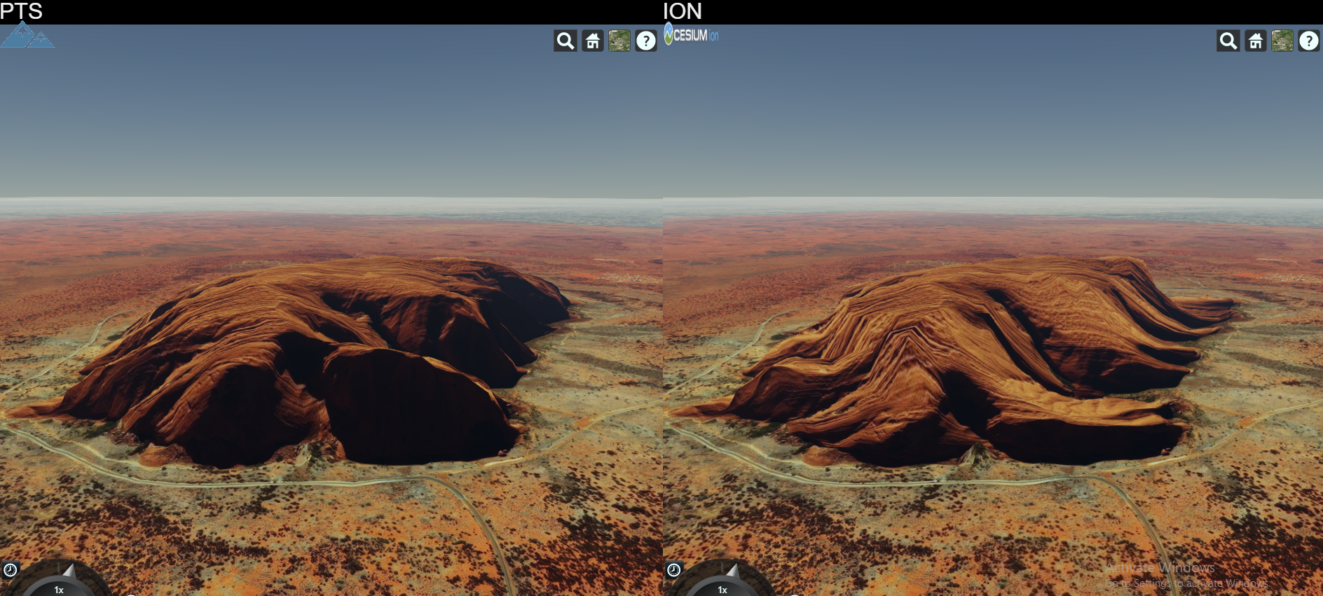
## High Fidelity When Compared

PTS is a software that produces terrain data to be served primarily for [CesiumJS](cesiumjs.org) library.
## Latest News (05.09.2019)
Cesium updated to 1.61. Now Earth looks way much cooler!


❗ High Resolution World Tileset is finally available.
It has many data curated already and will be more incoming. Currently the coverage is stated as below:
- 90 meters Antarctica
- 90 meters Arctic Area
- 90 meters above 60N Russia
- 30 meters World Wide except above areas
- 10 meters USA and Alaska
- 10 meters Iceland
- 10 meters Australia
- 10 meters Norway
- 8 meters New Zealand
- 5 meters for Luxembourg
More will be joining to this high resolution dataset and improvements will be made.
❗ Vesta and Ceres asteroids are in 3D. Go to terrainserver.com to view them.
❗ First Tileset Released [INFO](https://twitter.com/TerrainServer/status/1047090899975659520)
❗ World Tileset 90m whole world resolution is available for sale in order to support project. Lighting and Water extensions supported. Contact for details over Twitter. Preview [HERE](https://www.terrainserver.com/world90m).
## Features
* Cesium ION output like terrain generation
* Cesium STK Terrain Server dataset file format read support
* Cesium STK Terrain Server dataset file format write support
* Quantized Mesh format tile generation
* KML format tile generation
* Tile Lighting Support
* Watermask Support
* High Throughput Tile Server
## Published Tile Sets
#### Releases
### World High Resolution
High resolution whole world dataset. Extensions supported
### World 90m
90m whole world dataset. Extensions supported
#### Beta versions
### Mercury
665m resolution Mercury elevation data, original Mercury scale
### Moon
118m resolution Moon elevation data, original Moon scale
### Mars
232m resolution Mars elevation data, original Mars scale
### Topo 15
Elevation and Bathymetry data for whole wide world in 500m resolution
