https://github.com/nyurik/leaflet-vega
Leaflet layer based on Vega visualization grammar
https://github.com/nyurik/leaflet-vega
Last synced: 4 months ago
JSON representation
Leaflet layer based on Vega visualization grammar
- Host: GitHub
- URL: https://github.com/nyurik/leaflet-vega
- Owner: nyurik
- License: bsd-2-clause
- Created: 2017-06-16T20:01:37.000Z (almost 8 years ago)
- Default Branch: main
- Last Pushed: 2022-11-15T00:02:06.000Z (over 2 years ago)
- Last Synced: 2025-01-02T19:17:14.506Z (4 months ago)
- Language: JavaScript
- Size: 117 KB
- Stars: 47
- Watchers: 6
- Forks: 8
- Open Issues: 1
-
Metadata Files:
- Readme: README.md
- License: LICENSE
Awesome Lists containing this project
README
[](https://travis-ci.org/nyurik/leaflet-vega) [](https://www.npmjs.com/package/leaflet-vega)
# leaflet-vega
Leaflet layer based on Vega visualization grammar
[](https://www.youtube.com/watch?v=SBzDVXWdJWQ)
This Leaflet plugin adds a Vega layer on top of the map, and provides two way signaling between Leaflet and Vega. This way a complex Vega-based visualization can be added to a map without any additional JavaScript.
# Getting started
* Clone the repo
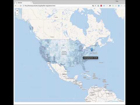
* open `demo/demo.html` file directly in your browser. No server is needed.
# Usage (code)
```javascript
const map = L.map('map');
// Optionally, add a base layer
L.tileLayer('https://maps.wikimedia.org/osm-intl/{z}/{x}/{y}.png', {
attribution: '© OpenStreetMap contributors'
}).addTo(map);
// Add a Vega graph to the map
L.vegaLayer(vegaGrapSpec).addTo(map);
```
Optionally, provide additional parameters to vegaLayer():
* `vega` - custom instance of Vega library
* `parseConfig` - Config to be passed to the Vega parse method
* `parseOptions` - Options to be passed to the Vega parse method
* `viewConfig` - Config to be passed ot the Vega View constructor
# Usage (Vega spec)
Your Vega spec may read `latitude`, `longitude`, and `zoom` signals, as well as set new values to them, e.g. if you need to change zoom level dynamically. Additionally, you may use `setMapView()` expression function to modify all of them at once. For example, if you have a set of regions on a map, and clicking the region should center the map, you can use this code (see demo file):
```yaml
"on": [{
"events": "@region:click",
"update": "setMapView(geoCentroid(null, datum))"
}]
```
The `setMapView()` can be used in any of these forms:
```yaml
setMapView(latitude, longitude); // center
setMapView(latitude, longitude, zoom); // center and zoom
setMapView([longitude, latitude]); // center with single array arg
setMapView([longitude, latitude], zoom); // center and zoom
setMapView([[lng1, lat1],[lng2, lat2]]); // bounding box center and zoom
```
All Vega specs are pre-populated with the following template. Your Vega graph may use any of the signals and the projection directly without declaring them, just like you use `width` or `height` signals.
```yaml
{
"padding": 0,
"autosize": "none",
// If true, graph will be repainted only after the map has finished moving
// When false, map move is not as smooth, but it allows some visual elements
// to stay in one place - such as the legend.
"delayRepaint": true,
// These signals are two-way bound with Leaflet
// A vega spec may alter the declaration to update signal value when needed
// For example, your spec may override zoom/lat/long definition to control map position:
// {"name": "zoom", "on": ..., "update": ...}
"signals": [
{"name": "zoom"},
{"name": "latitude"},
{"name": "longitude"}
],
// For convenience, this preset projection is injected if not defined by the user.
"projections": [
{
"name": "projection",
"type": "mercator",
// 256 is the tile size in pixels. The world width is (256 * 2^zoom)
// d3 mercator scaling is (world / 2 / PI)
"scale": {"signal": "256*pow(2,zoom)/2/PI"},
"rotate": [{"signal": "-longitude"}, 0, 0],
"center": [0, {"signal": "latitude"}],
"translate": [{"signal": "width/2"}, {"signal": "height/2"}],
"fit": false
}
]
}
```