https://github.com/oklabflensburg/open-area-map
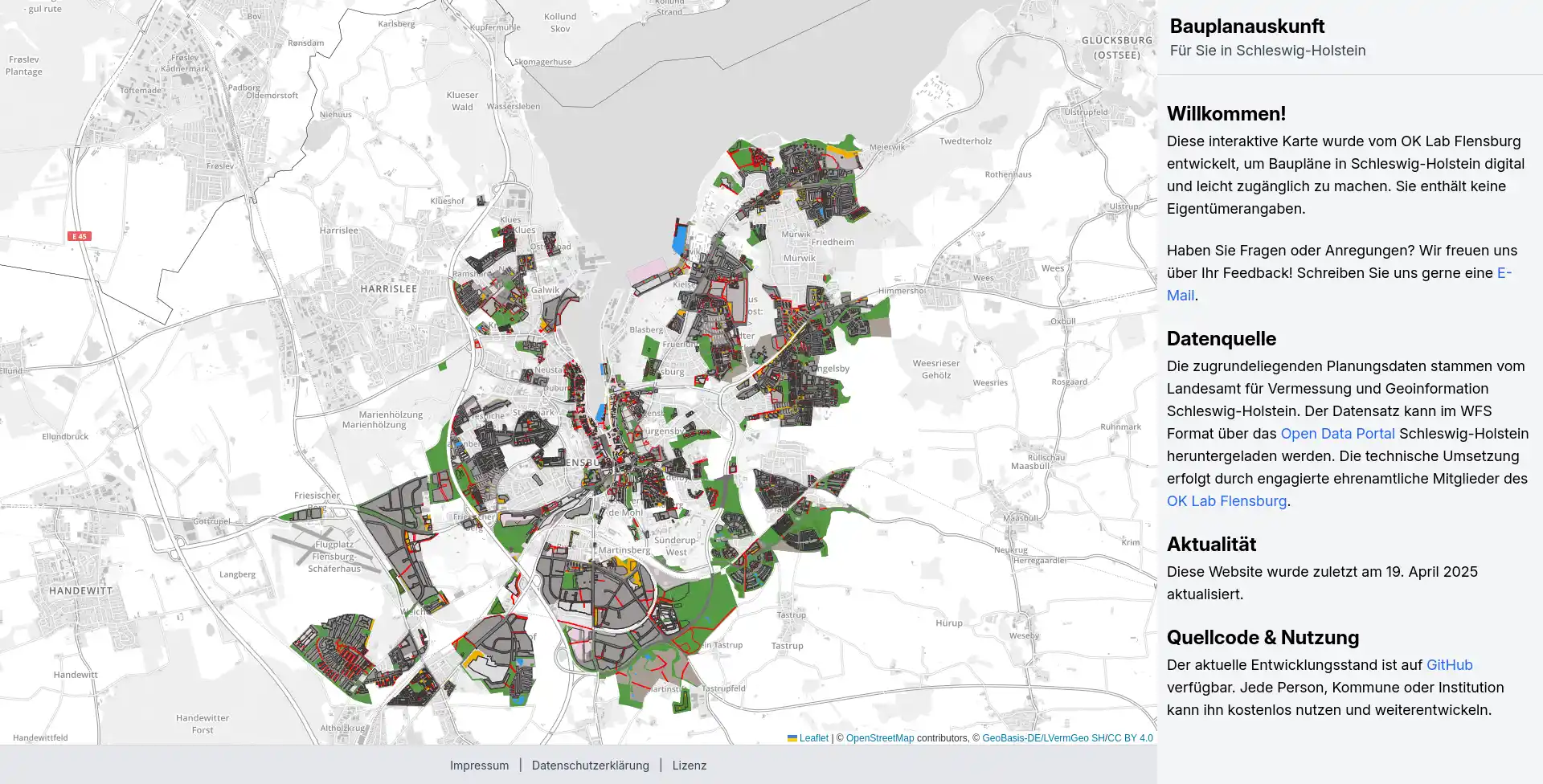
Diese interaktive Karte wurde vom OK Lab Flensburg entwickelt, um Baupläne in Schleswig-Holstein digital und leicht zugänglich zu machen.
https://github.com/oklabflensburg/open-area-map
bauplan fossgis map mapping open-source
Last synced: about 1 month ago
JSON representation
Diese interaktive Karte wurde vom OK Lab Flensburg entwickelt, um Baupläne in Schleswig-Holstein digital und leicht zugänglich zu machen.
- Host: GitHub
- URL: https://github.com/oklabflensburg/open-area-map
- Owner: oklabflensburg
- License: cc0-1.0
- Created: 2025-04-19T11:18:05.000Z (about 2 months ago)
- Default Branch: main
- Last Pushed: 2025-04-19T16:11:23.000Z (about 2 months ago)
- Last Synced: 2025-04-19T18:29:05.440Z (about 2 months ago)
- Topics: bauplan, fossgis, map, mapping, open-source
- Language: HTML
- Homepage: https://bauplanauskunft.oklabflensburg.de
- Size: 972 KB
- Stars: 0
- Watchers: 1
- Forks: 0
- Open Issues: 0
-
Metadata Files:
- Readme: README.md
- Contributing: CONTRIBUTING.md
- License: LICENSE
Awesome Lists containing this project
README
# Bauplanauskunft
[](https://github.com/oklabflensburg/open-area-map/actions/workflows/lint-css.yml)
[](https://github.com/oklabflensburg/open-area-map/actions/workflows/lint-html.yml)
[](https://github.com/oklabflensburg/open-area-map/actions/workflows/lint-js.yml)
[](https://github.com/oklabflensburg/open-area-map/actions/workflows/lighthouse.yml)
_Haftungsausschluss: Dieses Repository und die zugehörige Datenbank befinden sich derzeit in einer Beta-Version. Einige Aspekte des Codes und der Daten können noch Fehler enthalten. Bitte kontaktieren Sie uns per E-Mail oder erstellen Sie ein Issue auf GitHub, wenn Sie einen Fehler entdecken._
## Hintergrund
Diese interaktive Karte wurde vom OK Lab Flensburg entwickelt, um Baupläne in Schleswig-Holstein digital und leicht zugänglich zu machen.
## Datenquelle
Die zugrundeliegenden Planungsdaten stammen vom Landesamt für Vermessung und Geoinformation Schleswig-Holstein. Der Datensatz kann im WFS Format über das [Open Data Portal]() Schleswig-Holstein heruntergeladen werden.
## Aktualität
Die Aktualität der zugrundeliegenden Daten entnehmen Sie bitte der Projektseite.
## Setup
Install system dependencies and clone repository
```
sudo apt install wget
sudo apt install git git-lfs
sudo apt install python3 python3-pip python3-venv
sudo sh -c 'echo "deb http://apt.postgresql.org/pub/repos/apt $(lsb_release -cs)-pgdg main" > /etc/apt/sources.list.d/pgdg.list'
wget -qO- https://www.postgresql.org/media/keys/ACCC4CF8.asc | sudo tee /etc/apt/trusted.gpg.d/pgdg.asc &>/dev/null
sudo apt update
sudo apt install postgresql-16 postgis
sudo apt install gdal-bin
git clone https://github.com/oklabflensburg/open-area-map.git
```
Create a dot `.env` file inside the project root. Make sure to add the following content and repace values.
```
PARCEL_BASE_URL=http://localhost
[email protected]
PARCEL_CONTACT_PHONE="+49xx"
PARCEL_PRIVACY_CONTACT_PERSON="Firstname Lastname"
PARCEL_ADDRESS_NAME="Address Name"
PARCEL_ADDRESS_STREET="Address Street"
PARCEL_ADDRESS_HOUSE_NUMBER="House Number"
PARCEL_ADDRESS_POSTAL_CODE="Postal Code"
PARCEL_ADDRESS_CITY="City"
DB_PASS=postgres
DB_HOST=localhost
DB_USER=postgres
DB_NAME=postgres
DB_PORT=5432
```
---
## How to Contribute
Contributions are welcome! Please refer to the [CONTRIBUTING.md](CONTRIBUTING.md) guide for details on how to get involved.
---
## License
This repository is licensed under [CC0-1.0](LICENSE).