https://github.com/opengeoscience/geojs
High-performance visualization and interactive data exploration of scientific and geospatial location aware datasets
https://github.com/opengeoscience/geojs
canvas2d geojs geovisualization gis high-performance infovis javascript kitware opengeoscience opengis opensource performance-visualization scientific-visualization webgl
Last synced: 4 months ago
JSON representation
High-performance visualization and interactive data exploration of scientific and geospatial location aware datasets
- Host: GitHub
- URL: https://github.com/opengeoscience/geojs
- Owner: OpenGeoscience
- License: apache-2.0
- Created: 2013-09-19T21:39:25.000Z (almost 13 years ago)
- Default Branch: master
- Last Pushed: 2025-05-12T07:27:33.000Z (about 1 year ago)
- Last Synced: 2025-05-12T08:48:24.466Z (about 1 year ago)
- Topics: canvas2d, geojs, geovisualization, gis, high-performance, infovis, javascript, kitware, opengeoscience, opengis, opensource, performance-visualization, scientific-visualization, webgl
- Language: JavaScript
- Homepage: https://opengeoscience.github.io/geojs
- Size: 105 MB
- Stars: 459
- Watchers: 39
- Forks: 73
- Open Issues: 49
-
Metadata Files:
- Readme: README.md
- Changelog: CHANGELOG.md
- License: LICENSE
Awesome Lists containing this project
README

[](https://github.com/opengeoscience/geojs/actions)
[](https://codecov.io/github/OpenGeoscience/geojs?branch=master)
[](https://dx.doi.org/10.5281/zenodo.15459)
[](https://www.npmjs.com/package/geojs)
GeoJS is intended to bridge the gap between
[GIS](https://en.wikipedia.org/wiki/Geographic_information_system),
[Scientific Visualization](https://en.wikipedia.org/wiki/Scientific_visualization), and
[Infovis](https://en.wikipedia.org/wiki/Information_visualization).
GeoJS is more than just a GIS library as users can create scientific plots
such as vector and contour and can embed infovis plots using [D3.js](https://github.com/d3/d3).
*GeoJS aims for high-performance visualization and interactive data exploration of scientific
and geospatial location aware datasets*.
GeoJS supports features such as *Point*, *Line*, *Polygon*, and advanced features
such as [Pixelmap](https://opengeoscience.github.io/geojs/examples/pixelmap),
[Contour](https://opengeoscience.github.io/geojs/examples/contour),
[Heatmap](https://opengeoscience.github.io/geojs/examples/heatmap), and
[Choropleth](https://opengeoscience.github.io/geojs/examples/choropleth).
GeoJS can read and render data from [GeoJSON](https://opengeoscience.github.io/geojs/examples/geoJSON) files,
and [WMS](https://opengeoscience.github.io/geojs/examples/wms) servers.
Additional features includes [Annotations](https://opengeoscience.github.io/geojs/examples/annotations),
[Legends](https://opengeoscience.github.io/geojs/examples/legend),
[Animated Transitions](https://opengeoscience.github.io/geojs/examples/transitions), and
[Widgets](https://opengeoscience.github.io/geojs/examples/widgets).
GeoJS can also be used for visualizing medical imagery. See [Digital Slide Archive](https://digitalslidearchive.github.io/digital_slide_archive) for an example.
Examples
========
For live examples visit [Github.io](https://opengeoscience.github.io/geojs/examples/index.html)
[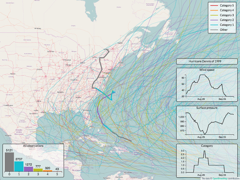](https://opengeoscience.github.io/geojs/examples/hurricanes)
Documentation
=============
You can find more information on GeoJS installation and usage in our [Documentation](https://opengeoscience.github.io/geojs).
There are some additional resources:
- [Quick-Start Guide](docs/quickstart.rst)
- [Provisioning for Development](docs/provisioning.rst)
- [Developer's Guide](docs/developers.rst)
- [User's Guide](docs/users.rst)
- [Examples](https://opengeoscience.github.io/geojs/examples)
- [Tutorials](https://opengeoscience.github.io/geojs/tutorials)
- [API Documentation](https://opengeoscience.github.io/geojs/apidocs)
Support
=======
We would love to get your feedback and bug reports. Please use GitHub issues.
Get Involved
============
We are open for collaboration. Kitware has been doing open source development
for the last 20 year and understands and appreciates what it takes to develop open
source software.
Related Efforts
===============
GeoJS has been used in various [Girder](https://github.com/girder) based applications such
as [Dansfield-App](https://github.com/Kitware/Danesfield-App) and [DIVE](https://github.com/Kitware/dive).