https://github.com/patriciogonzalezvivo/ofxstreetview
OF scraper for GoogleStreetView panoramas and depthmap
https://github.com/patriciogonzalezvivo/ofxstreetview
Last synced: about 1 month ago
JSON representation
OF scraper for GoogleStreetView panoramas and depthmap
- Host: GitHub
- URL: https://github.com/patriciogonzalezvivo/ofxstreetview
- Owner: patriciogonzalezvivo
- Created: 2014-03-26T16:48:52.000Z (about 11 years ago)
- Default Branch: master
- Last Pushed: 2016-04-09T17:31:51.000Z (about 9 years ago)
- Last Synced: 2024-10-18T19:33:22.754Z (6 months ago)
- Language: C++
- Size: 156 KB
- Stars: 185
- Watchers: 19
- Forks: 36
- Open Issues: 3
-
Metadata Files:
- Readme: README.md
Awesome Lists containing this project
README
# ofxStreetView
Trying to improve the stitching between panoramic views for my [SKYLINES II project](http://patriciogonzalezvivo.com/2014/skylines/) I came across some encrypted depth information inside Google Street View database. This become popularized by the short video [PointCloudCity](http://patriciogonzalezvivo.com/2014/pointcloudcity/) and later become SKYLINE III, a series of postcards revealing the invisible information of a city that is otherwise trapped inside corporate databases, freeing private information collected from public spaces.
[ 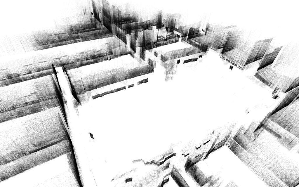 ](http://patriciogonzalezvivo.com/2014/pointcloudcity/wash-sq/)
[ 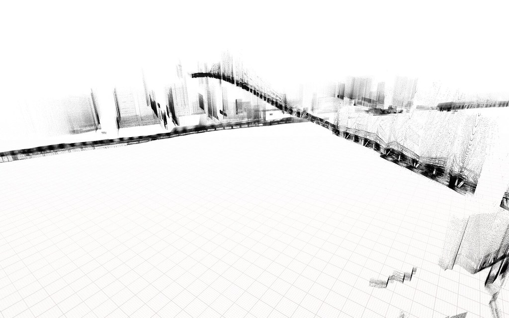 ](http://patriciogonzalezvivo.com/2014/skylines/queensboro)
[ 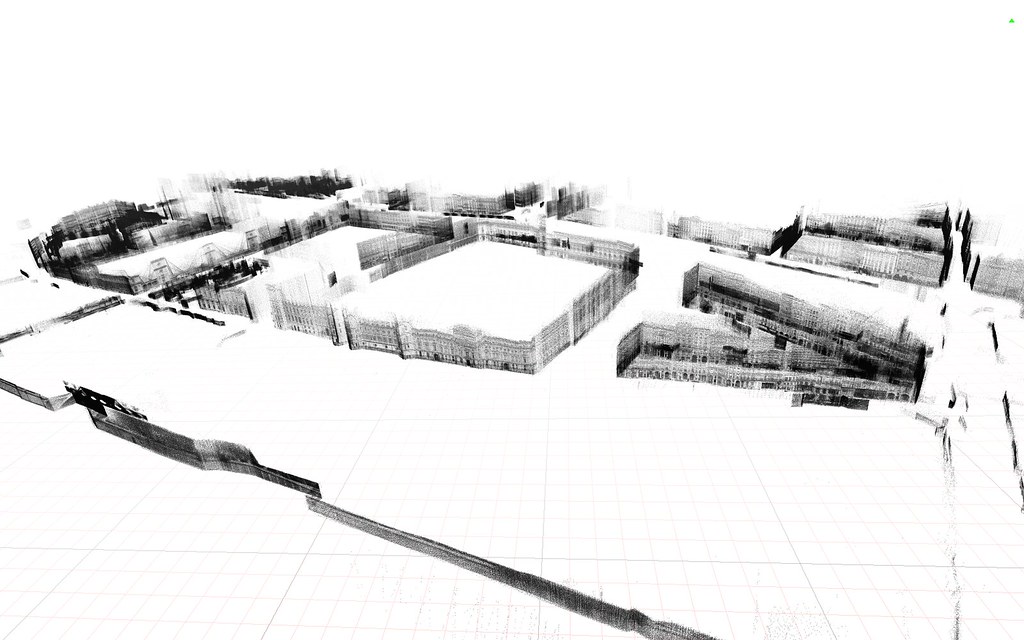 ](http://patriciogonzalezvivo.com/2014/skylines/ile-de-la-cite/)
## How it works
By doing the call:
http://cbk0.google.com/cbk?output=xml&panoid=[pano_id]&dm=1
We get information that looks like [this](http://maps.google.com/cbk?output=xml&cb_client=maps_sv&v=4&dm=1&hl=en&panoid=ki_KzVWkE87EgkPWg3QPXg)
At you can seee a depth image encoded in base64 (and zlib compressed)
This addon will construct the panoramic image (that you can get with ```getTextureReference()``` ) and then construct a 3D Mesh using the DepthMap information.
## Credits
- [ StreetView Explorer of Paul Wagener](https://github.com/PaulWagener/Streetview-Explorer)