Ecosyste.ms: Awesome
An open API service indexing awesome lists of open source software.
https://github.com/stoufa/gis-web-metro-tgm-stations
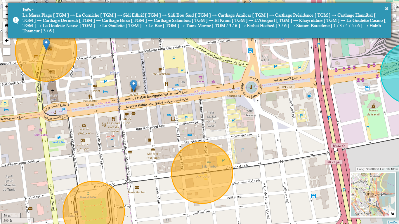
[EN] Web application that provides an interactive map representing the network of metro and TGM stations | [FR] Application Web qui présente une carte interactive représentant le réseau des stations métros et TGM
https://github.com/stoufa/gis-web-metro-tgm-stations
breadth-first-search geoserver graph javascript leaflet openstreetmap qgis shortest-path sig-web toastr web-mapping
Last synced: about 1 month ago
JSON representation
[EN] Web application that provides an interactive map representing the network of metro and TGM stations | [FR] Application Web qui présente une carte interactive représentant le réseau des stations métros et TGM
- Host: GitHub
- URL: https://github.com/stoufa/gis-web-metro-tgm-stations
- Owner: stoufa
- Created: 2017-08-08T09:25:00.000Z (over 7 years ago)
- Default Branch: master
- Last Pushed: 2020-06-14T16:12:00.000Z (over 4 years ago)
- Last Synced: 2024-11-06T06:14:57.387Z (3 months ago)
- Topics: breadth-first-search, geoserver, graph, javascript, leaflet, openstreetmap, qgis, shortest-path, sig-web, toastr, web-mapping
- Language: JavaScript
- Homepage:
- Size: 25.3 MB
- Stars: 2
- Watchers: 3
- Forks: 0
- Open Issues: 0
-
Metadata Files:
- Readme: README.md
Awesome Lists containing this project
README
        # GIS-Web-Metro-TGM-Stations

:us: Web application that provides an interactive map representing the network of metro and TGM stations

:fr: Application Web qui présente une carte interactive représentant le réseau des stations métros et TGM

-----

:us: We want to develop a Web GIS application to provide an interactive map representing the network of metro and TGM stations.

:fr: On souhaite développer une application SIG Web permettant d’offrir une carte interactive représentant le réseau des stations de métros et du TGM.


:us: The application must allow the user to choose a starting point and an end point then compute all possible paths between these 2 points.

:fr: L’application doit permettre l’utilisateur de choisir un point de départ et un point d’arrivée et de lui fournir le(s) chemin(s) qu’il peut emprunter.


:us: This is a project carried out as part of a course of `Geographical Information Systems (GIS)` for the 2nd year engineering students at the Higher Institute of Computer Science (ISI)

:fr: Il s'agit d'un projet réalisé dans le cadre d'un cours de `Systèmes d'Informations Géographiques (SIG)` destiné aux étudiants de la 2éme année ingénieur à l'Institut Supérieur d'Informatique (ISI)


   If you found this helpful, consider helping me by sending some Bitcoins to the following address. Thank you 😊


15m4Prjz4WLSsCgBcZTa62cUetiwo6sZKg