https://github.com/zhenyanghua/MeasureTool-GoogleMaps-V3
A mobile friendly measure tool for Google Maps JS API v3.
https://github.com/zhenyanghua/MeasureTool-GoogleMaps-V3
google-maps google-maps-api measure measure-area measure-distance measurement
Last synced: about 1 year ago
JSON representation
A mobile friendly measure tool for Google Maps JS API v3.
- Host: GitHub
- URL: https://github.com/zhenyanghua/MeasureTool-GoogleMaps-V3
- Owner: zhenyanghua
- License: apache-2.0
- Created: 2017-03-05T14:32:32.000Z (over 9 years ago)
- Default Branch: master
- Last Pushed: 2023-08-31T13:41:27.000Z (almost 3 years ago)
- Last Synced: 2025-04-17T13:31:15.127Z (about 1 year ago)
- Topics: google-maps, google-maps-api, measure, measure-area, measure-distance, measurement
- Language: JavaScript
- Homepage: https://zhenyanghua.github.io/MeasureTool-GoogleMaps-V3/
- Size: 1.53 MB
- Stars: 131
- Watchers: 8
- Forks: 80
- Open Issues: 36
-
Metadata Files:
- Readme: README.md
- License: LICENSE
Awesome Lists containing this project
- jimsghstars - zhenyanghua/MeasureTool-GoogleMaps-V3 - A mobile friendly measure tool for Google Maps JS API v3. (JavaScript)
README
# Measurement Tool for Google Maps JS API V3
A mobile friendly measure tool for Google Maps JS API v3.
## Features
- Mobile friendly with native browser touch events support.
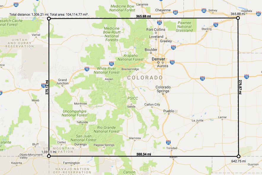
- Measure **length** and **area** with segment details.
- Support imperial, metric and nautical units.
- Support multiple languages (PR is welcome for more languages).
- color inversion for the dark/light background
- Built-in UI for measurement for convenience.
- API for more customizations.
## Demo
[Visit demo page](https://zhenyanghua.github.com/MeasureTool-GoogleMaps-V3)
## User usage
1. To **start** measuring, *right click* the map and choose **Measure distance**.
1. *Left click* the map, and the measurement between the two locations will display. Keep clicking to **add** more measurement waypoints.
1. To **remove** a waypoint, *left click* on the waypoint *(the first point cannot be removed)*.
1. To **insert** a waypoint on the measurement line, click the line. Waypoints can be moved by *clicking and dragging* them.
1. When the *first* point and the *last* point are close enough, the **area** will display.
1. To **end** measuring, *right click* the map and choose **Clear measurement**.
## Browser Compatibility
- Support various latest versions of modern browsers and IE 11.
- Chrome
- Firefox
- Safari
- Edge
- IE11
- iOS Chrome
- iOS Safari
## Documentations
- [Change List](https://github.com/zhenyanghua/MeasureTool-GoogleMaps-V3/blob/master/docs/CHANGES.md)
- [Developer Guide](https://github.com/zhenyanghua/MeasureTool-GoogleMaps-V3/blob/master/docs/GUIDE.md)
- [API Reference](https://github.com/zhenyanghua/MeasureTool-GoogleMaps-V3/blob/master/docs/REFERENCE.md)