https://github.com/zumbov2/swissgd
R Interface to the Geo-Information Platform of the Swiss Confederation
https://github.com/zumbov2/swissgd
Last synced: 12 months ago
JSON representation
R Interface to the Geo-Information Platform of the Swiss Confederation
- Host: GitHub
- URL: https://github.com/zumbov2/swissgd
- Owner: zumbov2
- License: other
- Created: 2021-03-16T07:28:46.000Z (over 5 years ago)
- Default Branch: main
- Last Pushed: 2022-11-21T02:01:24.000Z (over 3 years ago)
- Last Synced: 2024-01-17T01:22:53.442Z (over 2 years ago)
- Language: R
- Size: 3.3 MB
- Stars: 17
- Watchers: 5
- Forks: 0
- Open Issues: 0
-
Metadata Files:
- Readme: README.md
- License: LICENSE
Awesome Lists containing this project
README
[](https://cran.r-project.org/package=swissgd)

# swissgd
This R package is an interface to parts of the [Geo-Information Platform of the Swiss Confederation](https://www.geo.admin.ch/en/geo-services/geo-services/download-services.html) and **work-in-progress**. It provides functions to search and download geodata from [data.geo.admin.ch](https://data.geo.admin.ch/) and wraps around the [Spatial Temporal Asset Catalog (STAC) API](https://data.geo.admin.ch/api/stac/v0.9/).
The acquisition and use of data or services is free of charge, subject to the provisions on fair use. For more information, please see the [Terms of Use](https://www.geo.admin.ch/en/geo-services/geo-services/terms-of-use.html).
## Installation
Install from GitHub for a regularly updated version (latest: 0.1.2):
```r
install.packages("devtools")
devtools::install_github("zumbov2/swissgd")
```
# Functions
## `get_available_geodata`
Retrieves the names of all available datasets (*currently 570*) and returns the function (`download_geodata()` or `get_stac_assets()`) to obtain them.
``` r
swissgd::get_available_geodata()
#> # A tibble: 570 x 2
#> name retrieval_function
#>
#> 1 ch.are.agglomerationsverkehr swissgd::get_stac_assets()
#> 2 ch.are.alpenkonvention swissgd::get_stac_assets()
#> 3 ch.are.belastung-personenverkehr-bahn swissgd::get_stac_assets()
#> 4 ch.are.belastung-personenverkehr-bahn_zukunft swissgd::get_stac_assets()
#> 5 ch.are.belastung-personenverkehr-strasse swissgd::get_stac_assets()
#> 6 ch.are.belastung-personenverkehr-strasse_zukunft swissgd::get_stac_assets()
#> 7 ch.are.erreichbarkeit-miv swissgd::get_stac_assets()
#> 8 ch.are.erreichbarkeit-oev swissgd::get_stac_assets()
#> 9 ch.are.gemeindetypen swissgd::get_stac_assets()
#> 10 ch.are.gueteklassen_oev swissgd::get_stac_assets()
#> # ... with 560 more rows
```
## `search_geodata`
Searches for matches to argument `pattern` within the names of available datasets on the geo-information platform.
``` r
swissgd::search_geodata(pattern = "ÖV")
#> # A tibble: 6 x 2
#> name retrieval_function
#>
#> 1 ch.are.erreichbarkeit-oev swissgd::get_stac_assets()
#> 2 ch.are.gueteklassen_oev swissgd::get_stac_assets()
#> 3 ch.are.reisezeit-agglomerationen-oev swissgd::get_stac_assets()
#> 4 ch.are.reisezeit-oev swissgd::get_stac_assets()
#> 5 ch.bav.haltestellen-oev swissgd::get_stac_assets()
#> 6 ch.bav.kataster-belasteter-standorte-oev swissgd::download_geodata()
```
``` r
swissgd::search_geodata(pattern = "Alti")
#> # A tibble: 1 x 2
#> name retrieval_function
#>
#> 1 ch.swisstopo.swissalti3d swissgd::get_stac_assets()
```
## `show_metadata` and `show_preview`
These functions can be used to visit the entry of a dataset in the [Swiss Geometadata Catalogue](https://www.geocat.admin.ch) and preview the data on the mapping platform of the Swiss Confederation](https://map.geo.admin.ch).
``` r
swissgd::show_metadata("ch.are.erreichbarkeit-oev")
swissgd::show_preview("ch.are.erreichbarkeit-oev")
```
## `download_geodata`
Downloads datasets available directly from the geo-information platform. Other data can be obtained via the STAC API. See the functions below.
``` r
swissgd::download_geodata("ch.astra.baulinien-nationalstrassen")
```
## `get_stac_collections`
Displays a description of all data provided via the [Spatial Temporal Asset Catalog (STAC) REST Interface](https://data.geo.admin.ch/api/stac/v0.9/collections) on the geo-information platform (*currently 100*).
``` r
swissgd::get_stac_collections() %>% dplyr::select(title, id, description)
#> # A tibble: 100 x 3
#> title id descr~1
#>
#> 1 2000-Watt Sites ch.b~ "The 2~
#> 2 2G - GSM / EDGE availability ch.b~ "The b~
#> 3 3D buildings ch.s~ "swiss~
#> 4 3G - UMTS / HSPA availability ch.b~ "The b~
#> 5 4G - LTE / LTE-A availability ch.b~ "The b~
#> 6 5G - NR availability ch.b~ "The b~
#> 7 Accessibility by public transport depending on travel time and~ ch.a~ "Acces~
#> 8 Accessibility by road depending on travel time and potential a~ ch.a~ "Acces~
#> 9 Aeronautical Chart ICAO Switzerland 1:500'000 ch.b~ "The o~
#> 10 Alpine Convention ch.a~ "The p~
#> # ... with 90 more rows, and abbreviated variable name 1: description
```
## `get_stac_assets`
Calls the STAC API on the geo-information platform and returns the download links to geo-specific assets. Here the aerial photo with a ground resolution of 10 cm of a part of my hometown Aarau is queried. WGS84, LV03 and LV95 coordinates are possible.
``` r
swissgd::get_stac_assets(
collection_id = "ch.swisstopo.swissimage-dop10",
lon = 645685,
lat = 249287
)
#> # A tibble: 2 x 7
#> type href created updated eo:gs~1 proj:~2 check~3
#>
#> 1 image/tiff; application=geotiff~ http~ 2021-0~ 2021-0~ 0.1 2056 122088~
#> 2 image/tiff; application=geotiff~ http~ 2021-0~ 2021-0~ 2 2056 122053~
#> # ... with abbreviated variable names 1: `eo:gsd`, 2: `proj:epsg`,
#> # 3: `checksum:multihash`
```
## `download_stac_assets`
Downloads assets from the STAC API that were previously queried with a `get_stac_assets()` call.
``` r
res <- swissgd::get_stac_assets(
collection_id = "ch.swisstopo.swissimage-dop10",
lon = 645685,
lat = 249287
)
swissgd::download_stac_assets(res)
```
# Examples
## Spatial distribution of place name suffixes
### Setup
**Idea**: Examine and visualise the spatial distribution of place name suffixes using spatial kernel density estimation.
**Datasets**: ch.swisstopo.swissnames3d, ch.swisstopo.swissboundaries3d-land-flaeche.fill
**Packages**: `sf`, `raster`, `btb`, `ggplot2` and friends
**Script**: [ex1_swissnames.R](https://github.com/zumbov2/swissgd/blob/main/examples/example1/ex1_swissnames.R)
### Some Results
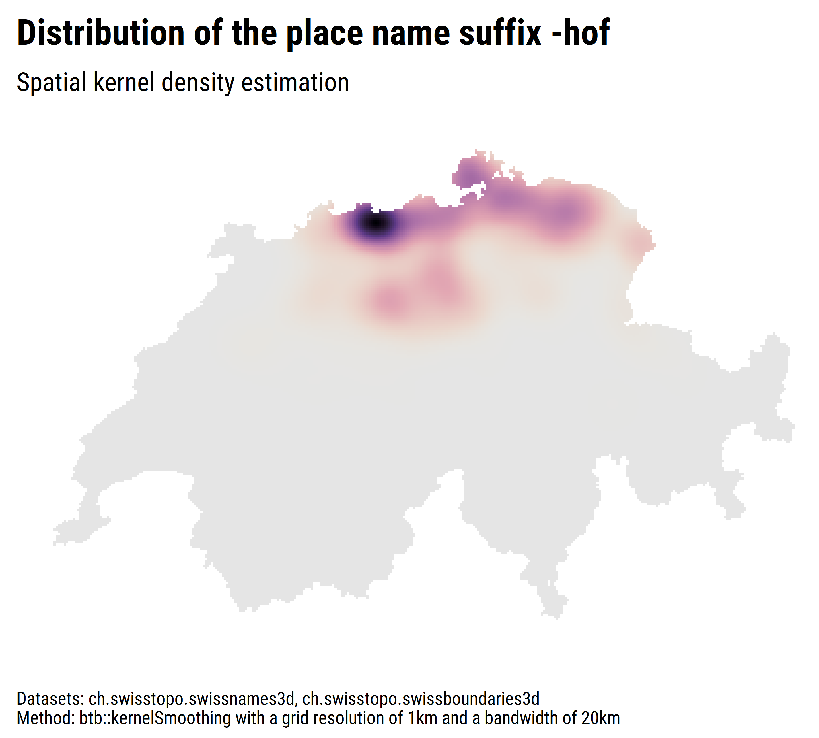
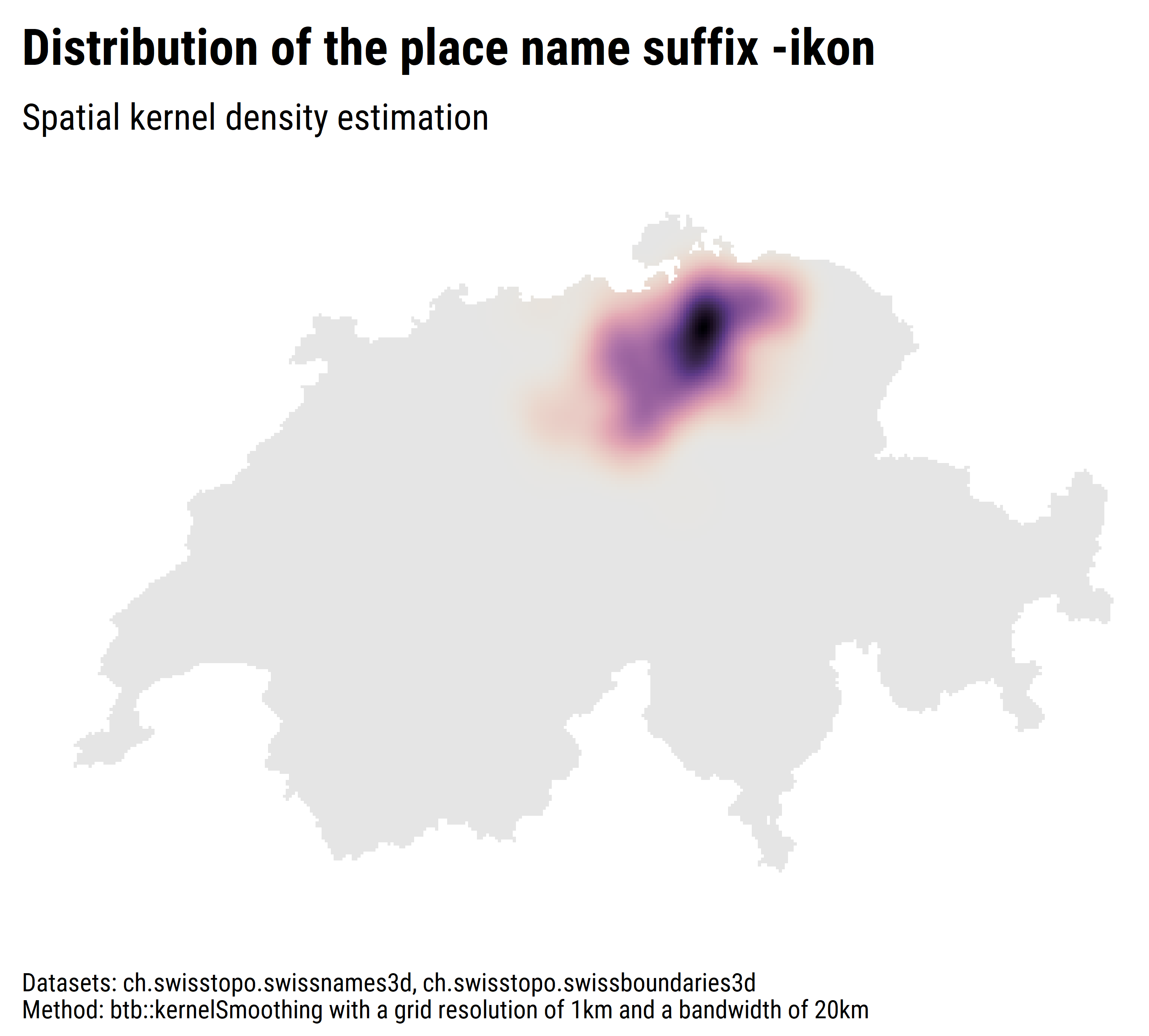
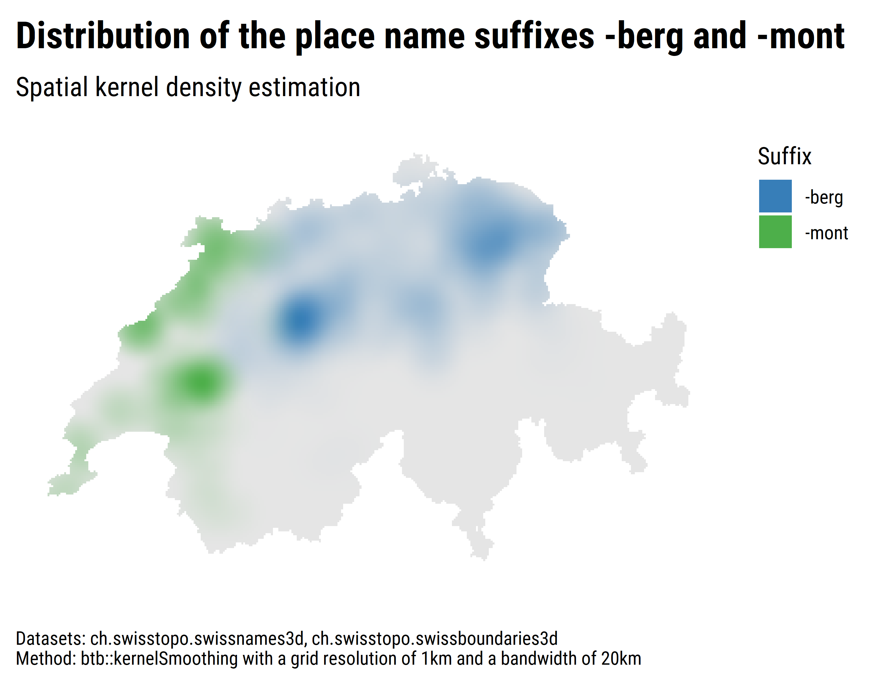
## Reachability by public transport
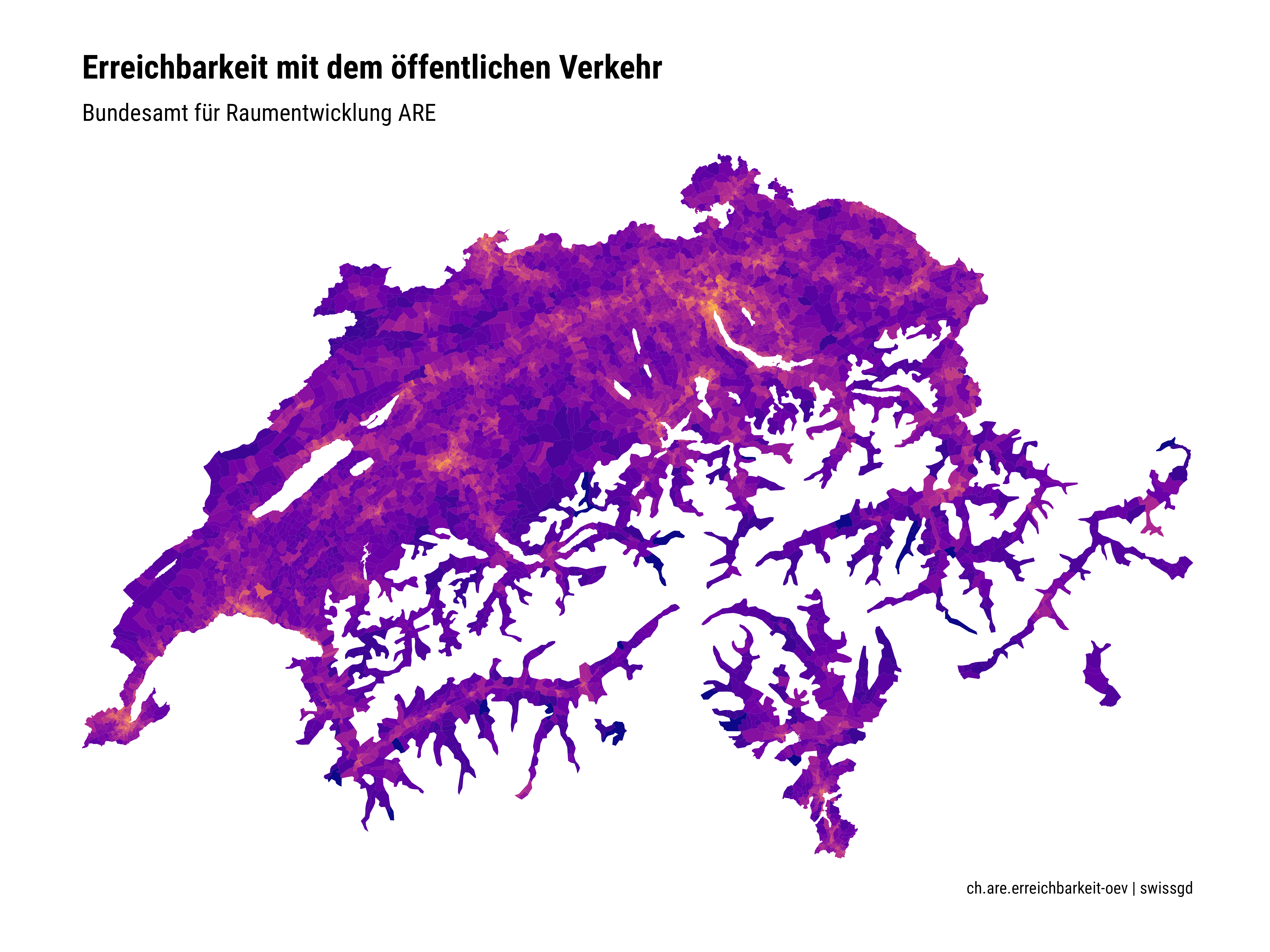
### Setup
**Goal**: Testing the newly available data via the STAC API.
**Datasets**: ch.are.erreichbarkeit-oev
**Packages**: `sf` and `ggplot2`
**Script**: [ex2.R](https://github.com/zumbov2/swissgd/blob/main/examples/example2/ex2.R)
### Results