https://github.com/zverok/worldize
Simple coloured countries drawing
https://github.com/zverok/worldize
Last synced: over 1 year ago
JSON representation
Simple coloured countries drawing
- Host: GitHub
- URL: https://github.com/zverok/worldize
- Owner: zverok
- Created: 2016-01-21T13:08:31.000Z (over 10 years ago)
- Default Branch: master
- Last Pushed: 2018-08-20T06:25:14.000Z (almost 8 years ago)
- Last Synced: 2025-03-29T16:07:52.108Z (over 1 year ago)
- Language: Ruby
- Size: 9.97 MB
- Stars: 262
- Watchers: 8
- Forks: 10
- Open Issues: 1
-
Metadata Files:
- Readme: README.md
Awesome Lists containing this project
README
Worldize
========
**Worldize** is a very simple and naive gem to make world map, with
countries painted according to some values (see also
[choropleth map](https://en.wikipedia.org/wiki/Choropleth_map)).
## Demonstration
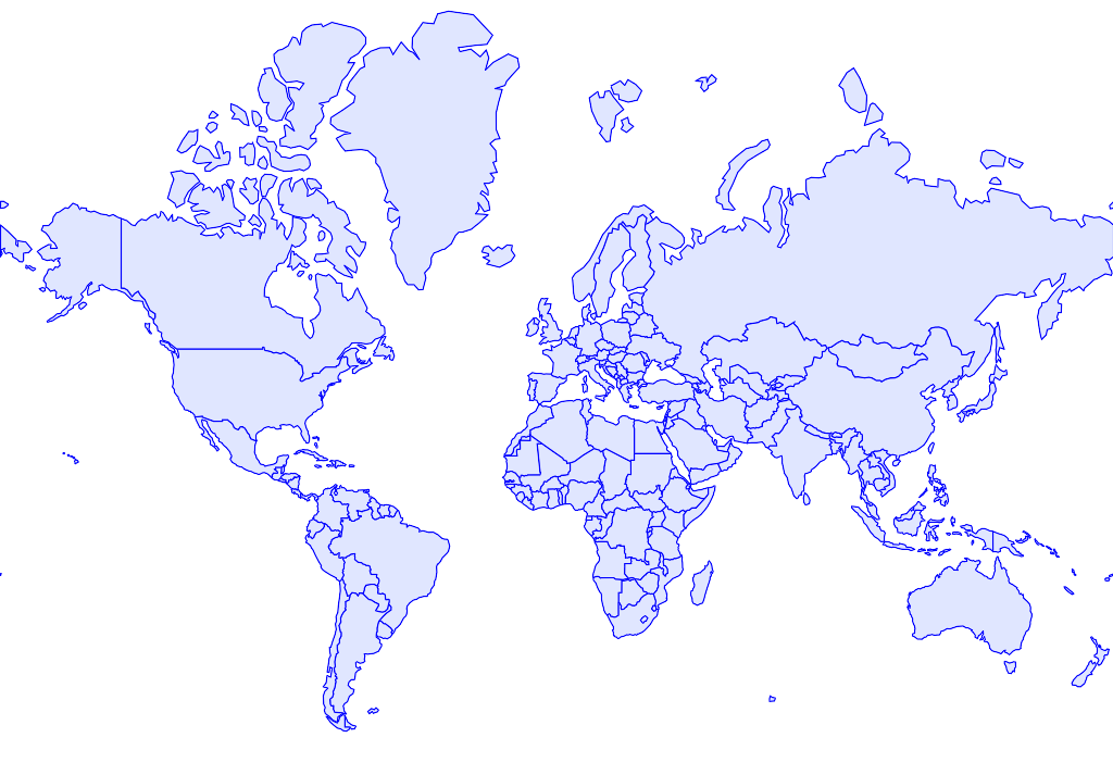
### Just monochrome countries
**Code:**
```ruby
worldize = Worldize::Countries.new
img = worldize.draw # Magick::Image of RMagick
img.write('blank.png')
```
**Picture:**
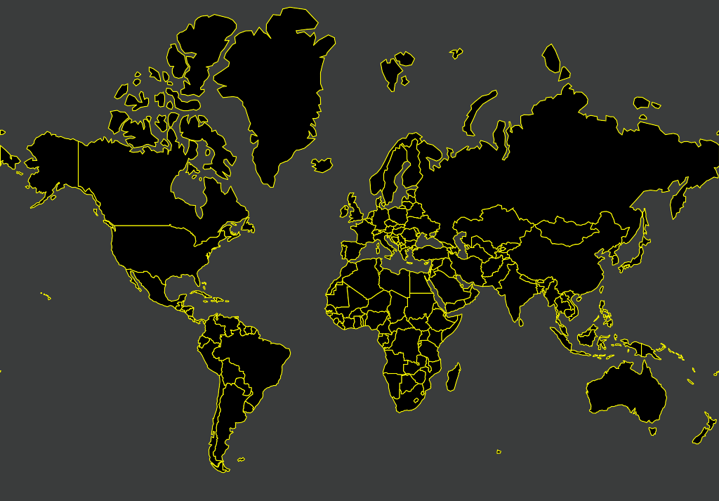
You can set some options (see [Usage](#usage) for details):
```ruby
worldize = Worldize::Countries.new
img = worldize.draw(ocean: '#3A3C3C', land: 'black', border: 'yellow')
img.write('night.png')
```
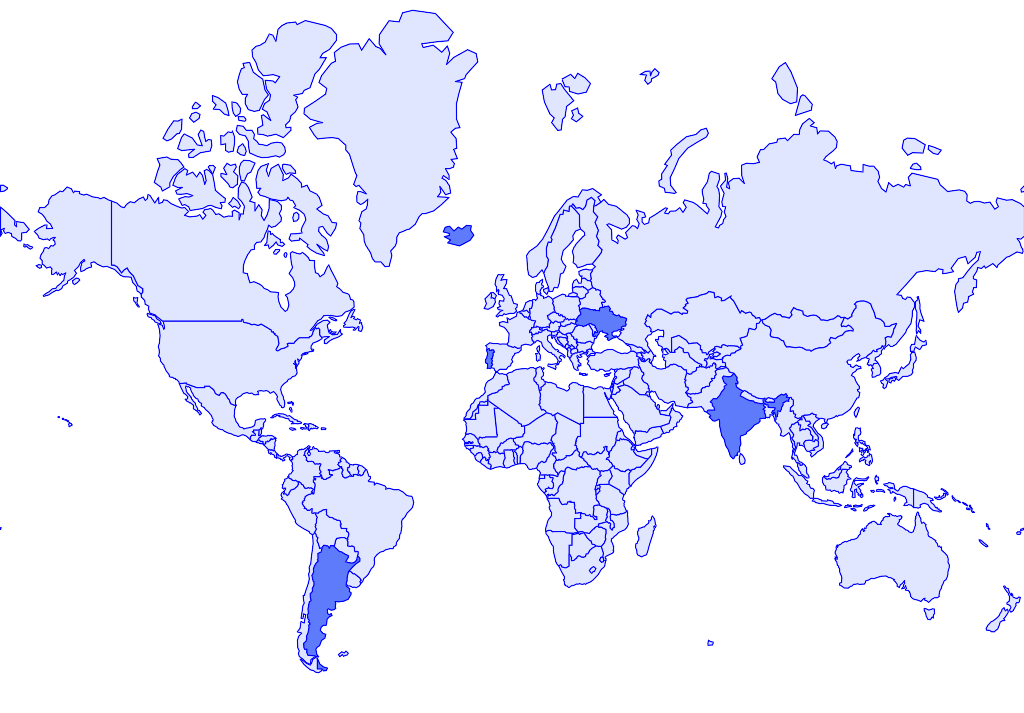
### Some countries highlighted
**Code:**
```ruby
Worldize::Countries.new.
draw_highlighted('Ukraine', 'Argentina', 'Portugal', 'India', 'Iceland').
write('highlighted.png')
```
**Picture:**
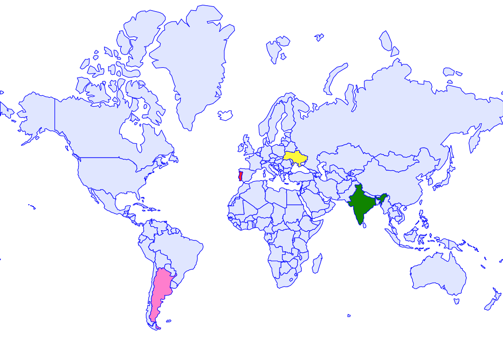
### Countries painted in custom colors
**Code:**
```ruby
Worldize::Countries.new.
draw(
'Ukraine' => '#FCF83D',
'Argentina' => '#FE7ECD',
'Portugal' => '#FD1F30',
'India' => '#108400',
'Iceland' => 'white'
).
write('colors.png')
```
**Picture:**
### Countries painted in gradient according to value
```ruby
worldize = Worldize::Countries.new
# create hash like {country name => value}
values = {
'Argentina' => 100,
'Bolivia' => 50,
'Chile' => 180
#...
}
worldize.
draw_gradient(
'#D4F6C8', # gradient from this color
'#247209', # ...to that color
values # ...according to value
).
write('gradient.png')
```
**Picture:**
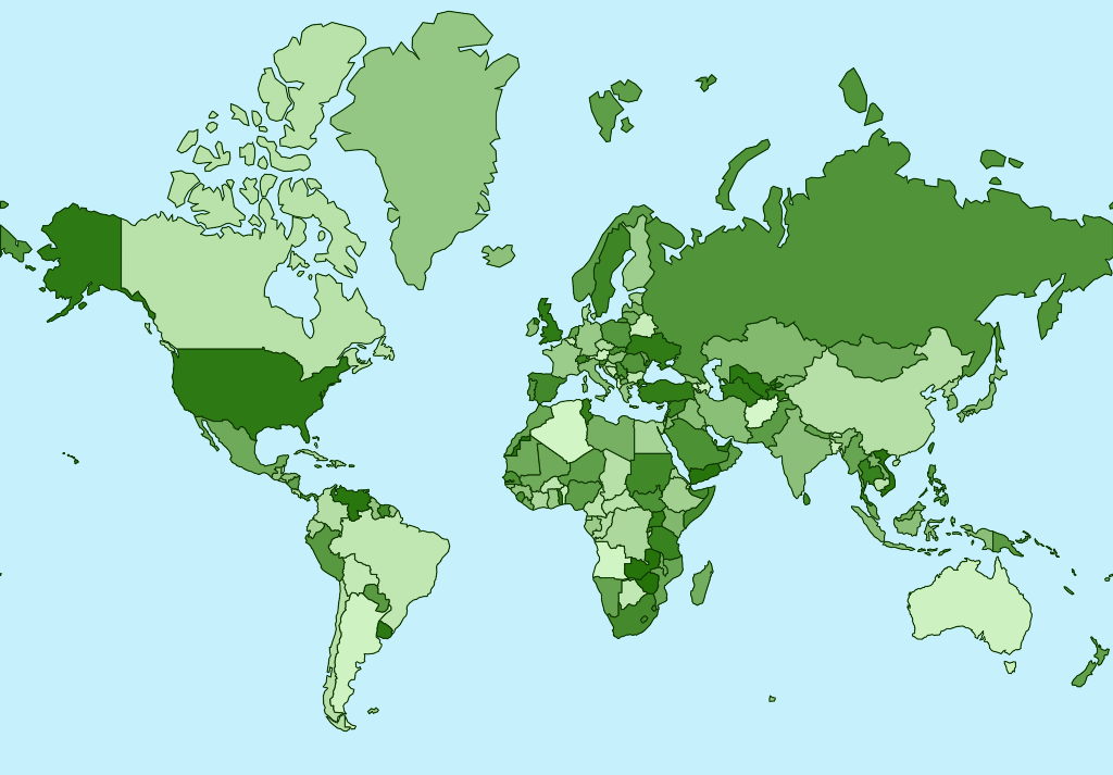
**NB:** on this picture, countries associated with values according to
their position in sorted countries list, just like this:
```ruby
values = worldize.country_names.sort.each_with_index.to_a.to_h
# => {"Afghanistan"=>0, "Albania"=>1, "Algeria"=>2, "Angola"=>3, "Antarctica"=>4, "Argentina"=>5, "Armenia"=>6, ...
```
## Installation
It's gem, named `worldize`. Do your usual `[sudo] gem install worldize`
or adding `gem 'worldize'` to Gemfile routine.
## Usage
### From code
Create an object: `w = Worldize::Countries.new`.
#### Generic draw
Synopsys: `#draw('Country1' => 'color1', 'Country2' => 'color2', ... , option: value)`
`Country` can be either full name or
[ISO 3-letter code](https://en.wikipedia.org/wiki/ISO_3166-1_alpha-3).
For list of known names/codes there are service functions `#country_names`
and `#country_codes`.
`color` is any color value RMagick [can understand](http://www.imagemagick.org/script/color.php)
(for ex., hex-codes or common color names).
Options awailable:
* `width` of resulting image (default 1024 pixels, height will be
calculated automatically);
* `land`—default color of land (for countries not specified in list);
* `ocean`—color of ocean;
* `border`—color of country borders.
Both countries and options can be omitted completely (resulting in
all countries being drawn in default color).
#### Select several countries with one color
Synopsys: `#draw_selected('Country1', 'Country2', ... , option: value)`.
Options are the same as for `#draw` plus `:selected` background color
(reasonable default exists, so can be omitted).
#### Paint countries proportionally to some measurement
Synopsys: `#draw_gradient('from_color', 'to_color', 'Country1' => value1, 'Country2' => value2, ... option: value)`
Values should be numeric and colors will be scaled to gradient between
`from_color` and `to_color`.
### From command line
Use `worldize --help` for details.
**Highlight countries:**
```
worldize -o highlighted.png \
--highlight-countries Ukraine,Argentina,Portugal,India,Iceland
```
**Colors for countries:**
```
worldize -o color.png \
--paint-countries "Ukraine:#FCF83D,Argentina:#FE7ECD,Portugal:#FD1F30,India:#108400,Iceland:white"
```
or from CSV file
```
worldize -o color.png \
--paint-countries country_colors.csv --csv-columns 0,1
```
means firs and second columns contain country name and color. Or from CSV
with headers:
```
worldize -o color.png \
--paint-countries country_colors.csv
--csv-headers --csv-columns Country,Color
```
**Color-coded statisitcs**
```
worldize -o gradient.png \
--from-color '#D4F6C8' --to-color '#247209' \
--grad-countries "Argentina:100,Bolivia:50,Chile:180"
```
or from CSV file, like above:
```
worldize -o gradient.png \
--from-color '#D4F6C8' --to-color '#247209' \
--grad-countries country_stats.csv --csv-headers --columns "Country,Population 2015"
```
## How this was done
* Country borders are taken from [geojson](http://data.okfn.org/data/datasets/geo-boundaries-world-110m)
(sourced from Natural Earth by OpenData license);
* Web Mercator map projection calculated according to [formulae](https://en.wikipedia.org/wiki/Web_Mercator#Formulas);
* Result is cropped to exclude polar areas (which has nothing interesting
in any case!);
* RMagick for drawing, awesome [color](https://rubygems.org/gems/color/versions/1.8)
gem for gradients calculation.
## TODO
_(or not TODO, depends on whether somebody needs this)_
* Options to draw legend and other text labels;
* Use of some open-licensed tiles/picture of the world as background
image.
## Authors
[Victor Shepelev](http://zverok.github.io/)
## License
MIT.